  • Facebook
  • Twitter
  • LinkedIn
  • YouTube
  • Instagram
  • Sign Up
  • Log In
  • Dashboard
  • Logout
    • My Account
    • Dashboard
    • Profile
    • Saved items
    • Logout
Home
  • About WBOC
  • Our Team
  • Programming
  • Contact Us
  • Careers
  • Internships
  • Policies
  • Report It
  • Get our newsletters
  • WBOC Apps
News
  • Wicomico County
  • Worcester County
  • Somerset County
  • Dorchester County
  • Caroline County
  • Talbot County
  • Queen Annes County
  • Sussex County
  • Kent County
  • Accomack County
  • National News
  • International News
  • Latest Newscasts
  • Video Center
Weather
  • Forecast
  • Radar
  • Satellite
  • On The Waters
  • Weather Cameras
  • Closings
Delmarva Sports Network
Shows
  • DelmarvaLife
  • Outdoors Delmarva
  • Delmarva Home Show
Features
  • Obituaries
  • Heartbeat of Delmarva
  • Proud To Serve
  • The M Report
  • Farming Our Future
  • Farm to Table Scholarship
  • Bless Our Children
  • Events: Shore Living Expo
Radio
  • 100.9% Classic Country WAAI
  • 107.1 The Duck
  • 102.5 WBOC FM
  • 93.5 The Beach
  • 107.7 BIG Classic Rock
  • 103.9 and 106.3 Coast Country
  • Watch Live
  • Apps
  • Contact Us
  • My Account
  • Sign Up
  • Log In
  • Dashboard
  • Logout
    • My Account
    • Dashboard
    • Profile
    • Saved items
    • Logout
  • Facebook
  • Twitter
  • LinkedIn
  • YouTube
  • Instagram
  • 75° Partly Cloudy
    • Salisbury, MD (21801)

      Today

      Partly cloudy early followed by cloudy skies overnight. Slight chance of a rain shower. Low around 70F. Winds NE at 10 to 15 mph..

      Tonight

      Partly cloudy early followed by cloudy skies overnight. Slight chance of a rain shower. Low around 70F. Winds NE at 10 to 15 mph.

      Updated: August 20, 2025 @ 9:30 pm

    • Full Forecast
site-logo
Watch Live

Newscast Schedule

View Programming Schedule
site-logo
  • 75°
  • Home
  • News
    • Wicomico County
    • Worcester County
    • Somerset County
    • Dorchester County
    • Caroline County
    • Talbot County
    • Queen Annes County
    • Sussex County
    • Kent County
    • Accomack County
    • National News
    • International News
    • Latest Newscasts
    • Video Center
    • Report It
  • Weather
    • Forecast
    • Radar
    • Satellite
    • On The Waters
    • Weather Cameras
    • Closings
  • Delmarva Sports Network
  • Shows
    • DelmarvaLife
    • Outdoors Delmarva
    • Delmarva Home Show
  • Features
    • Obituaries
    • Heartbeat of Delmarva
    • The M Report
    • Proud To Serve
    • Farming Our Future
    • Farm to Table Scholarship
    • Jefferson Awards
    • Delmarva Experts
    • Bless Our Children
    • Events: Shore Living Expo
  • Radio
    • 100.9% Classic Country WAAI
    • 107.1 The Duck
    • 93.5 The Beach
    • 107.7 BIG Classic Rock
    • 103.9 and 106.3 Coast Country
    • 102.5 WBOC FM
  • About Us
    • About WBOC
    • Our Team
    • Channel Finder
    • Apps
    • Contact Us
    • Get our newsletters
    • Careers
    • Internships
    • Policies
    • WBOC Solar Farm
Broadcast Schedule

On air schedule

Weather Alert

Weather Alert

...COASTAL FLOOD ADVISORY NOW IN EFFECT UNTIL 4 AM EDT THURSDAY...
...COASTAL FLOOD WATCH IN EFFECT FROM FRIDAY AFTERNOON THROUGH
SATURDAY MORNING...

* WHAT...For the Coastal Flood Advisory, up to one half foot of
inundation above ground level in low-lying areas near
shorelines and tidal waterways. For the Coastal Flood Watch,
one to three feet of inundation above ground level possible in
low-lying areas near shorelines and tidal waterways.

* WHERE...Dorchester, Wicomico and Somerset Counties.

* WHEN...For the Coastal Flood Advisory, until 4 AM EDT
Thursday. For the Coastal Flood Watch, from Friday afternoon
through Saturday morning.

* IMPACTS...Numerous roads may be closed. Low lying property
including homes, businesses, and some critical infrastructure
may be inundated. Some shoreline erosion may occur.

PRECAUTIONARY/PREPAREDNESS ACTIONS...

If travel is required, allow extra time as some roads may be
closed. Do not drive around barricades or through water of
unknown depth. Take the necessary actions to protect flood-prone
property.

&&

Time of high total tides are approximate to the nearest hour.

CAMBRIDGE MD
MLLW CATEGORIES - MINOR 3.5 FT, MODERATE 4.0 FT, MAJOR 4.5 FT
MHHW CATEGORIES - MINOR 1.5 FT, MODERATE 2.0 FT, MAJOR 2.5 FT

TOTAL      TOTAL    DEPARTURE
DAY/TIME    TIDE       TIDE     FROM NORM   WAVES    FLOOD
FT MLLW    FT MHHW       FT       FT      IMPACT
--------  ---------  ---------  ---------  -------  --------
21/03 AM     3.2        1.2        0.9        1       NONE
21/02 PM     2.2        0.2        0.4        2       NONE
22/05 AM     3.2        1.2        1.0        2       NONE
22/03 PM     3.7        1.7        1.8        1      MINOR
23/05 AM     4.2        2.2        1.9        1     MODERATE
23/05 PM     3.8        1.8        1.7        1      MINOR

BISHOPS HEAD MD
MLLW CATEGORIES - MINOR 3.2 FT, MODERATE 3.7 FT, MAJOR 4.2 FT
MHHW CATEGORIES - MINOR 1.1 FT, MODERATE 1.6 FT, MAJOR 2.1 FT

TOTAL      TOTAL    DEPARTURE
DAY/TIME    TIDE       TIDE     FROM NORM   WAVES    FLOOD
FT MLLW    FT MHHW       FT       FT      IMPACT
--------  ---------  ---------  ---------  -------  --------
21/12 AM     3.3        1.2        0.9       1-2     MINOR
21/12 PM     2.7        0.6        0.6       2-3      NONE
22/02 AM     3.5        1.4        1.1       2-3     MINOR
22/01 PM     3.9        1.8        1.7       1-2    MODERATE
23/02 AM     4.3        2.2        1.9        1      MAJOR
23/02 PM     4.0        1.9        1.8        1     MODERATE

CRISFIELD MD
MLLW CATEGORIES - MINOR 3.5 FT, MODERATE 4.0 FT, MAJOR 5.0 FT
MHHW CATEGORIES - MINOR 1.3 FT, MODERATE 1.8 FT, MAJOR 2.8 FT

TOTAL      TOTAL    DEPARTURE
DAY/TIME    TIDE       TIDE     FROM NORM   WAVES    FLOOD
FT MLLW    FT MHHW       FT       FT      IMPACT
--------  ---------  ---------  ---------  -------  --------
20/11 PM     3.4        1.2        1.2        1       NONE
21/11 AM     2.5        0.3        1.0        1       NONE
22/01 AM     3.7        1.5        1.5        1      MINOR
22/12 PM     3.7        1.5        2.1        1      MINOR
23/01 AM     4.3        2.1        2.1        1     MODERATE
23/01 PM     3.7        1.5        2.0        1      MINOR

&&

Weather Alert

This product covers CENTRAL AND EASTERN VIRGINIA...NORTHEAST NORTH CAROLINA...AND THE LOWER MARYLAND EASTERN SHORE

**TROPICAL STORM WARNINGS CONTINUE **


NEW INFORMATION
---------------

* CHANGES TO WATCHES AND WARNINGS:
- None

* CURRENT WATCHES AND WARNINGS:
- A Tropical Storm Warning is in effect for Accomack, Eastern
Currituck, Northampton, Virginia Beach, and Western Currituck

* STORM INFORMATION:
- About 500 miles south of Ocean City MD or about 420 miles
south-southeast of Norfolk VA
- 31.2N 73.6W
- Storm Intensity 110 mph
- Movement North or 360 degrees at 14 mph

SITUATION OVERVIEW
------------------

Hurricane Erin, currently off the southeast coast of the United
States, will gradually turn northward with the center of the storm
remaining well offshore of the Middle Atlantic. However, Erin is
expected to grow in size which may allow for tropical storm conditions
to impact areas close to the coast from the Virginia Eastern Shore,
Virginia Beach, Currituck County, as well as the Maryland, Virginia and
northeast North Carolina Coastal Waters. Winds of 30 to 40 mph with
gusts to 45 mph are possible close to the coast south of Chincoteague.

Regardless of the exact track, Erin is expected to bring high surf,
significant dune and beach erosion and moderate to locally major tidal
flooding to the area. Seas will increase to 12 to 18 feet over the
coastal waters by Thursday which will allow for significant beach and
dune erosion for the coast especially around the times of high tide on
Thursday morning and Thursday evening. In addition, moderate to
locally major coastal flooding is expected during the Thursday
afternoon and evening high tide with inundation of 1 to 3 feet above
normally high ground. A coastal flood watch is in effect for the
entire area bordering the bay, tidal rivers and ocean.

POTENTIAL IMPACTS
-----------------

* SURGE:
Protect against locally hazardous surge having possible limited impacts
across all of the shoreline from Maryland through Virginia to
NE North Carolina, including the lower and middle Chesapeake Bay.


Potential impacts in this area include:
- Widespread storm surge flooding of vulnerable areas will result
in an elevated threat of property damage to homes and
businesses near the waterfront and shoreline.
- Sections of low-lying vulnerable roads, parking lots and
property will likely become flooded. Driving conditions could
become dangerous in places where flooding covers the road.
- Moderate to severe beach erosion is likely, including heavy
surf possibly breaching dunes, especially in vulnerable
locations. Strong and dangerous rip currents are likely.
- Minor to moderate damage to marinas, docks, boardwalks, and
piers is likely. A few small craft broken away from moorings.

Elsewhere across CENTRAL AND EASTERN VIRGINIA...NORTHEAST NORTH
CAROLINA...AND THE LOWER MARYLAND EASTERN SHORE, little to no impact
is anticipated.

* WIND:
Protect against hazardous wind having possible limited impacts across
the area close to the shoreline from Chincoteague VA to Duck NC.

Potential impacts in this area include:
- Damage to porches, awnings, carports, sheds, and unanchored
mobile homes. Unsecured lightweight objects blown about.
- Many large tree limbs broken off. A few trees snapped or
uprooted, especially if soils are saturated. Some roadway signs
will sustain damage.
- A few roads will be impassable from debris. Hazardous driving
conditions on bridges and other elevated roadways.
- Scattered power and communications outages.

Elsewhere across CENTRAL AND EASTERN VIRGINIA...NORTHEAST NORTH
CAROLINA...AND THE LOWER MARYLAND EASTERN SHORE, little to no impact
is anticipated.

PRECAUTIONARY/PREPAREDNESS ACTIONS
----------------------------------

* EVACUATIONS:
A mandatory evacuation for the off-road area of Corolla effective at 9
AM EDT Wednesday August 20th.

* OTHER PREPAREDNESS INFORMATION:

When making safety and preparedness decisions, do not focus on the
exact forecast track since hazards such as flooding rain, damaging wind
gusts, storm surge, and tornadoes extend well away from the center of
the storm.

Always heed the advice of local officials and comply with orders that
are issued. Do not needlessly jeopardize your life or the lives of
others.

Closely monitor weather.gov, NOAA Weather Radio and local news outlets
for official storm information. Listen for possible changes to the
forecast.


* ADDITIONAL SOURCES OF INFORMATION:
- For information on appropriate preparations see
www.readyvirginia.gov, readync.org or mema.maryland.gov
- For the latest weather and storm information go to
weather.gov/wakefield

NEXT UPDATE
-----------

The next local statement will be issued by the National Weather
Service in Wakefield VA around 12 AM EDT, or sooner if conditions
warrant.

Weather Alert

...SMALL CRAFT ADVISORY NOW IN EFFECT FROM 8 PM THIS EVENING TO
6 AM EDT FRIDAY...

* WHAT...Northeast winds 15 to 25 kt with gusts up to 30 kt and
waves 2 to 4 ft expected.

* WHERE...Chesapeake Bay from Drum Point MD to Smith Point VA,
Tidal Potomac from Cobb Island MD to Smith Point VA and
Tangier Sound and the inland waters surrounding Bloodsworth
Island.

* WHEN...From 8 PM this evening to 6 AM EDT Friday.

* IMPACTS...Conditions will be hazardous to small craft.

PRECAUTIONARY/PREPAREDNESS ACTIONS...

Inexperienced mariners, especially those operating smaller
vessels, should avoid navigating in hazardous conditions.

&&

eclipse


Closings

Click here to view closings and delays

Advanced Search Close Search
From
To
Close Search
9:27
Magician Michael Kaminskas is Bringing The Magic with a Skillful Card Trick
Delmarvalife

Magician Michael Kaminskas is Bringing The Magic with a Skillful Card Trick

  • Updated 7 hrs ago

Magician Michael Kaminskas joins us to share how he lifts spirits, learned his skills, and performs an impressive card trick.

7:43
James Shows Off Some Nifty Card Tricks That Will Make Your Jaw Drop
Delmarvalife

James Shows Off Some Nifty Card Tricks That Will Make Your Jaw Drop

  • Updated Oct 25, 2024

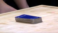
Card tricks that'll make your jaw drop are up James' sleeve as he demonstrates a few magical moves.

site-logo
  • Facebook
  • Twitter
  • LinkedIn
  • YouTube
  • Instagram

Sections

  • Latest Newscasts
  • Local News
  • Weather
  • Features
  • DelmarvaLife
  • Outdoors Delmarva
  • Delmarva Home Show
  • CoastTV
  • Telemundo Delmarva
  • Delmarva Sports Network
  • Video Center

Services

  • Search
  • Pay My Bill
  • Advertise With Us
  • Contact Us
  • Careers
  • Internships

Browser Compatibility

Your browser is out of date and potentially vulnerable to security risks.
We recommend switching to one of the following browsers:

Microsoft Edge Google Chrome Firefox
FCC Public File Applications & Related Materials EEO Public File Report FCC Closed Captioning Concerns Children's Programming Transparency Requirements for Group Health Plans
© Copyright 2025 WBOC TV 1729 N. Salisbury BLVD, Salisbury, MD  | Terms of Use  | Privacy Policy
Powered by BLOX Content Management System from BLOX Digital.