  • Facebook
  • Twitter
  • LinkedIn
  • YouTube
  • Instagram
  • Sign Up
  • Log In
  • Dashboard
  • Logout
    • My Account
    • Dashboard
    • Profile
    • Saved items
    • Logout
Home
  • About WBOC
  • Our Team
  • Programming
  • Contact Us
  • Careers
  • Internships
  • Policies
  • Report It
  • Get our newsletters
  • WBOC Apps
News
  • Wicomico County
  • Worcester County
  • Somerset County
  • Dorchester County
  • Caroline County
  • Talbot County
  • Queen Annes County
  • Sussex County
  • Kent County
  • Accomack County
  • National News
  • International News
  • Latest Newscasts
  • Video Center
Weather
  • Forecast
  • Radar
  • Satellite
  • On The Waters
  • Weather Cameras
  • Closings
Delmarva Sports Network
Shows
  • DelmarvaLife
  • Outdoors Delmarva
  • Delmarva Home Show
Features
  • Bless Our Children
  • Holiday House
  • Obituaries
  • Heartbeat of Delmarva
  • Proud To Serve
  • The M Report
  • Farming Our Future
  • Farm to Table Scholarship
  • Events: Job Fair
Radio
  • WDEL
  • 100.9% Classic Country
  • 107.1 The Duck
  • 102.5 WBOC FM
  • 93.5 The Beach
  • 107.7 BIG Classic Rock
  • 103.9 & 106.3 Coast Country
  • 93.7 WSTW
  • WXCY 103.7 & 96.9
  • WCEI 96.7
  • 94.3 Dockside
  • Watch Live
  • Apps
  • Contact Us
  • My Account
  • Sign Up
  • Log In
  • Dashboard
  • Logout
    • My Account
    • Dashboard
    • Profile
    • Saved items
    • Logout
  • Facebook
  • Twitter
  • LinkedIn
  • YouTube
  • Instagram
  • 11° Clear
    • Salisbury, MD (21801)

      Today

      Mainly cloudy. A few flurries or snow showers possible. High 24F. Winds N at 10 to 15 mph..

      Tonight

      Light snow in the evening. Then remaining cloudy overnight. Very cold. Low 14F. Winds N at 15 to 25 mph. Chance of snow 40%.

      Updated: January 31, 2026 @ 3:06 am

    • Full Forecast
site-logo
Watch Live

Newscast Schedule

View Programming Schedule
site-logo
  • 11°
  • Home
  • News
    • Wicomico County
    • Worcester County
    • Somerset County
    • Dorchester County
    • Caroline County
    • Talbot County
    • Queen Anne's County
    • Sussex County
    • Kent County
    • Accomack County
    • National News
    • International News
    • Latest Newscasts
    • Video Center
    • Report It
  • Weather
    • Forecast
    • Radar
    • Satellite
    • On The Waters
    • Weather Cameras
    • Closings
  • Delmarva Sports Network
  • Shows
    • DelmarvaLife
    • Outdoors Delmarva
    • Delmarva Home Show
  • Features
    • Bless Our Children
    • Holiday House
    • Obituaries
    • Heartbeat of Delmarva
    • The M Report
    • Proud To Serve
    • Farming Our Future
    • Farm to Table Scholarship
    • Jefferson Awards
    • Delmarva Experts
    • Events: Job Fair
  • Radio
    • WDEL
    • 100.9% Classic Country
    • 107.1 The Duck
    • 93.5 The Beach
    • 107.7 BIG Classic Rock
    • 103.9 & 106.3 Coast Country
    • 102.5 WBOC FM
    • 93.7 WSTW
    • WXCY 103.7 & 96.9
    • WCEI 96.7
    • 94.3 WINX
  • About Us
    • About WBOC
    • Our Team
    • Channel Finder
    • Apps
    • Contact Us
    • Get our newsletters
    • Careers
    • Internships
    • Policies
    • WBOC Solar Farm
  • Report It

WINTER STORM

Download Weather App

Broadcast Schedule

On air schedule

Weather Alert

Weather Alert

...COLD WEATHER ADVISORY NOW IN EFFECT UNTIL 10 AM EST SUNDAY...
...WIND ADVISORY REMAINS IN EFFECT FROM 10 PM THIS EVENING TO 4 PM
EST SUNDAY...
...EXTREME COLD WATCH IS CANCELLED...

* WHAT...For the Cold Weather Advisory, very cold wind chills as low
as 3 below expected. For the Wind Advisory, north winds 20 to 30
mph with gusts up to 50 mph expected.

* WHERE...Inland Worcester, Maryland Beaches, Somerset, and Wicomico
Counties.

* WHEN...For the first Cold Weather Advisory, second Cold Weather
Advisory, and third Cold Weather Advisory, until 10 AM EST Sunday.
For the Wind Advisory, from 10 PM this evening to 4 PM EST Sunday.

* IMPACTS...Gusty winds will blow around unsecured objects. Tree
limbs could be blown down and a few power outages may result. The
cold wind chills as low as zero could result in hypothermia if
precautions are not taken.

PRECAUTIONARY/PREPAREDNESS ACTIONS...

Winds this strong can make driving difficult, especially for high
profile vehicles. Use extra caution.

Use caution while traveling outside. Wear appropriate clothing, a
hat, and gloves.

&&

Weather Alert

...SMALL CRAFT ADVISORY REMAINS IN EFFECT UNTIL 6 PM EST
SATURDAY...
...GALE WARNING REMAINS IN EFFECT FROM 6 PM SATURDAY TO MIDNIGHT
EST SUNDAY NIGHT...
...HEAVY FREEZING SPRAY WARNING REMAINS IN EFFECT FROM 1 AM TO
10 AM EST SUNDAY...

* WHAT...For the Small Craft Advisory, north winds 10 to 20 kt
with gusts up to 25 kt expected. For the Gale Warning, north
winds 25 to 35 kt with gusts up to 45 kt and waves 3 to 6 ft
expected. For the Heavy Freezing Spray Warning, heavy freezing
spray at a rate of 2 cm per hour or greater expected, and may
rapidly accumulate on vessels.

* WHERE...Chesapeake Bay from Drum Point MD to Smith Point VA,
and Tangier Sound and the inland waters surrounding
Bloodsworth Island.

* WHEN...For the Small Craft Advisory, from midnight tonight to
6 PM EST Saturday. For the Gale Warning, from 6 PM Saturday to
midnight EST Sunday night. For the Heavy Freezing Spray
Warning, from 1 AM to 10 AM EST Sunday.

* IMPACTS...Operating a vessel in heavy freezing spray is
hazardous. Freezing spray may render mechanical and electronic
components inoperative. Rapid ice accretion on decks and
superstructures may result in a catastrophic loss of
stability. Strong winds will cause hazardous waves which could
capsize or damage vessels.

PRECAUTIONARY/PREPAREDNESS ACTIONS...

Mariners should prepare for dangerous accumulation of ice on
their vessel. If possible, remain in port, avoid the warning area
or conduct mitigation.

Mariners should alter plans to avoid these hazardous conditions.
Remain in port, seek safe harbor, alter course, and/or secure the
vessel for hazardous conditions.

&&

Weather Alert

...WINTER WEATHER ADVISORY REMAINS IN EFFECT FROM 7 AM SATURDAY TO 4
PM EST SUNDAY...

* WHAT...Snow expected. Total snow accumulations between 1 and 3
inches. Winds gusting as high as 45 mph.

* WHERE...Dorchester, Inland Worcester, Maryland Beaches, Somerset,
and Wicomico Counties.

* WHEN...From 7 AM Saturday to 4 PM EST Sunday.

* IMPACTS...Plan on slippery road conditions. Gusty winds could
bring down tree branches.

PRECAUTIONARY/PREPAREDNESS ACTIONS...

Slow down and use caution while traveling. Call 511 for road
information.

&&

Closings

Click here to view closings and delays

Advanced Search Close Search
From
To
Close Search
Ribbon cut on Edward Q. Wilgus Community Clinic in Salisbury
Latest News

Ribbon cut on Edward Q. Wilgus Community Clinic in Salisbury

  • Anthony Evangelista
  • Updated Aug 14, 2025

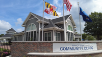
A vision more than 130 years in the making became reality Thursday as TidalHealth cut the ribbon on the Edward Q. Wilgus Community Clinic in Salisbury.

UMES Community Mourns After Loss of Two Students
Latest News

UMES Community Mourns After Loss of Two Students

  • Jack Ford
  • Updated Oct 7, 2024

At the UMES campus in Princess Anne, the atmosphere is heavy as students and faculty mourn the loss of two young lives. 

6:22
We Discuss Some Of The Programs You May Not Have Known About With The Talbot Health Department
Delmarvalife

We Discuss Some Of The Programs You May Not Have Known About With The Talbot Health Department

  • Updated Nov 1, 2023

Another Resource That Can Help You In Tough Times Is Your Local Health Department. We'll Learn About A Few Of The Programs Offered In *Talbot …

Bills Aimed at Increasing Mental Health Resources in Delaware Signed into Law
Latest News

Bills Aimed at Increasing Mental Health Resources in Delaware Signed into Law

  • Jana Ruark
  • Updated Aug 16, 2023

DELAWARE- Several pieces of legislation were signed into law Wednesday aimed at improving mental health access for students and helping more p…

1:50
A Helping Hand for Inmates About to be Released
Latest News

A Helping Hand for Inmates About to be Released

  • Updated Aug 25, 2022

More than 30 businesses and agencies made their way to Eastern Correctional Institute in Somerset County, so inmates about to be released coul…

Paid Content by For All Seasons – Dealing with Stress
Delmarvalife

Paid Content by For All Seasons – Dealing with Stress

  • By Lisa Bryant
  • Feb 16, 2022

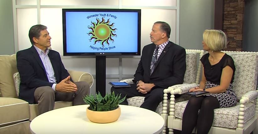
We all do with stress at some point. Some are more stressed than others. Beth Anne Langrell, CEO of For All Seasons talks with us about why we…

Core Counseling Strategies
Community

Core Counseling Strategies

  • By Lisa Bryant
  • Apr 27, 2021
Paid Segment By Core Counseling Strategies – Staying Focused On Your Core
Community

Paid Segment By Core Counseling Strategies – Staying Focused On Your Core

  • By Leah Rizzo
  • Apr 27, 2021

Getting back on your feet can mean focusing on your core. We introduce you to a man from Core Counseling Strategies who has made it his missio…

Worcester-Youth
Delmarvalife

Worcester-Youth

  • By Lauren Hitch
  • Updated Jun 13, 2023
worcesteryouth
Delmarvalife

worcesteryouth

  • By Lauren Hitch
  • Updated Jun 13, 2023
  •  
  • 1 of 2
  •  
site-logo
  • Facebook
  • Twitter
  • LinkedIn
  • YouTube
  • Instagram

Sections

  • Latest Newscasts
  • Local News
  • Weather
  • Features
  • DelmarvaLife
  • Outdoors Delmarva
  • Delmarva Home Show
  • CoastTV
  • Telemundo Delmarva
  • Delmarva Sports Network
  • Video Center

Services

  • Search
  • Pay My Bill
  • Advertise With Us
  • Contact Us
  • Careers
  • Internships

Browser Compatibility

Your browser is out of date and potentially vulnerable to security risks.
We recommend switching to one of the following browsers:

Microsoft Edge Google Chrome Firefox
FCC Public File Applications & Related Materials EEO Public File Report FCC Closed Captioning Concerns Children's Programming Transparency Requirements for Group Health Plans
© Copyright 2026 WBOC TV 1729 N. Salisbury BLVD, Salisbury, MD  | Terms of Use  | Privacy Policy
Powered by BLOX Content Management System from BLOX Digital.