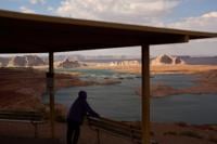
A person stands at an overlook near the Wahweap Marina on Lake Powell at the Glen Canyon National Recreation Area, Tuesday, July 14, 2026, near Page, Ariz. (AP Photo/John Locher)
A person stands at an overlook near the Wahweap Marina on Lake Powell at the Glen Canyon National Recreation Area, Tuesday, July 14, 2026, near Page, Ariz. (AP Photo/John Locher)

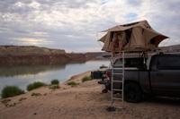
Mark Budzko rubs his eyes as he wakes up while camping beside Lake Powell at the Glen Canyon National Recreation Area, Wednesday, July 15, 2026, near Big Water, Utah. (AP Photo/John Locher)

Maria Max rests while camping along Lake Powell at the Glen Canyon National Recreation Area, Wednesday, July 15, 2026, near Big Water, Utah. (AP Photo/John Locher)

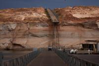
People ride a golf cart beneath a protruding dock used during higher water levels at the Antelope Point Marina on Lake Powell at the Glen Canyon National Recreation Area, Tuesday, July 14, 2026, near Page, Ariz. (AP Photo/John Locher)

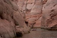
People paddle through a canyon on Lake Powell at the Glen Canyon National Recreation Area, Wednesday, July 15, 2026, near Page, Ariz. (AP Photo/John Locher)

Boaters swim in a canyon on Lake Powell at the Glen Canyon National Recreation Area, Wednesday, July 15, 2026, near Page, Ariz. (AP Photo/John Locher)

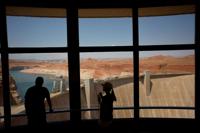
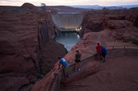
People look at the Glen Canyon Dam, Tuesday, July 14, 2026, near Page, Nev. (AP Photo/John Locher)

People view the Glen Canyon Dam from a viewpoint above the Colorado River, Tuesday, July 14, 2026, in Page, Ariz. (AP Photo/John Locher)

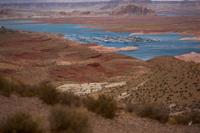
The Wahweap Marina floats on Lake Powell at the Glen Canyon National Recreation Area, Wednesday, July 15, 2026, near Page, Ariz. (AP Photo/John Locher)

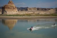
Vitalii Volna drives a jet ski on Lake Powell at the Glen Canyon National Recreation Area, Wednesday, July 15, 2026, near Big Water, Utah. A bathtub ring of light minerals on Lone Rock behind shows the high water mark of the lake. (AP Photo/John Locher)