  • Facebook
  • Twitter
  • LinkedIn
  • YouTube
  • Instagram
  • Sign Up
  • Log In
  • Dashboard
  • Logout
    • My Account
    • Dashboard
    • Profile
    • Saved items
    • Logout
Home
  • About WBOC
  • Our Team
  • Programming
  • Contact Us
  • Careers
  • Internships
  • Policies
  • Report It
  • Get our newsletters
  • WBOC Apps
News
  • Wicomico County
  • Worcester County
  • Somerset County
  • Dorchester County
  • Caroline County
  • Talbot County
  • Queen Annes County
  • Sussex County
  • Kent County
  • Accomack County
  • National News
  • International News
  • Latest Newscasts
  • Video Center
Weather
  • Forecast
  • Radar
  • Satellite
  • On The Waters
  • Weather Cameras
  • Closings
Delmarva Sports Network
Shows
  • DelmarvaLife
  • Outdoors Delmarva
  • Delmarva Home Show
Features
  • Travels With Charlie
  • Bless Our Children
  • Proud To Serve
  • The M Report
  • Heartbeat of Delmarva
  • Honoring Delmarva Farmers
  • Farm to Table Scholarship
  • Obituaries
  • Events: DSN Outdoors Expo
Radio
  • 100.9% Classic Country WAAI
  • 107.1 The Duck
  • 102.5 WBOC FM
  • 93.5 The Beach
  • 107.7 BIG Classic Rock
  • 103.9 and 106.3 Coast Country
  • Watch Live
  • Apps
  • Contact Us
  • My Account
  • Sign Up
  • Log In
  • Dashboard
  • Logout
    • My Account
    • Dashboard
    • Profile
    • Saved items
    • Logout
  • Facebook
  • Twitter
  • LinkedIn
  • YouTube
  • Instagram
  • 70° Rain
    • Salisbury, MD (21801)

      Today

      Thunderstorms this evening followed by occasional showers overnight. A few storms may be severe. Low 58F. Winds WSW at 15 to 25 mph. Chance of rain 100%..

      Tonight

      Thunderstorms this evening followed by occasional showers overnight. A few storms may be severe. Low 58F. Winds WSW at 15 to 25 mph. Chance of rain 100%.

      Updated: May 30, 2025 @ 9:23 pm

    • Full Forecast
site-logo
Watch Live

Newscast Schedule

View Programming Schedule
site-logo
  • 70°
  • Home
  • News
    • Local News
    • National News
    • International News
    • Latest Newscasts
    • Video Center
    • Wicomico County
    • Worcester County
    • Somerset County
    • Dorchester County
    • Caroline County
    • Talbot County
    • Queen Annes County
    • Sussex County
    • Kent County
    • Accomack County
    • Report It
  • Weather
    • Forecast
    • Radar
    • Satellite
    • On The Waters
    • Weather Cameras
    • Closings
  • Delmarva Sports Network
  • Shows
    • DelmarvaLife
    • Outdoors Delmarva
    • Delmarva Home Show
  • Features
    • Heartbeat of Delmarva
    • The M Report
    • Proud To Serve
    • Travels With Charlie
    • Honoring Delmarva Farmers
    • Farm to Table Scholarship
    • Jefferson Awards
    • Obituaries
    • Delmarva Experts
    • Bless Our Children
    • Events: DSN Outdoors Expo
  • Radio
    • 100.9% Classic Country WAAI
    • 107.1 The Duck
    • 93.5 The Beach
    • 107.7 BIG Classic Rock
    • 103.9 and 106.3 Coast Country
    • 102.5 WBOC FM
  • About Us
    • About WBOC
    • Our Team
    • Channel Finder
    • Apps
    • Contact Us
    • Get our newsletters
    • Careers
    • Internships
    • Policies
    • WBOC Solar Farm
Broadcast Schedule

On air schedule

Weather Alert

Weather Alert

...GALE WARNING REMAINS IN EFFECT UNTIL 8 AM EDT SATURDAY...
...SMALL CRAFT ADVISORY REMAINS IN EFFECT FROM 8 AM TO 6 PM EDT
SATURDAY...

* WHAT...For the Gale Warning, west winds 20 to 30 kt with gusts
up to 45 kt and waves 2 to 4 ft. For the Small Craft Advisory,
west winds 10 to 20 kt with gusts up to 30 kt expected.

* WHERE...Tidal Potomac River from Key Bridge to Smith Point VA,
and Chesapeake Bay and adjoining estuaries north of Smith
Point VA.

* WHEN...For the Gale Warning, until 8 AM EDT Saturday. For the
Small Craft Advisory, from 8 AM to 6 PM EDT Saturday.

* IMPACTS...Strong winds will cause hazardous waves which could
capsize or damage vessels.

PRECAUTIONARY/PREPAREDNESS ACTIONS...

Mariners should alter plans to avoid these hazardous conditions.
Remain in port, seek safe harbor, alter course, and/or secure the
vessel for hazardous conditions.

&&

Weather Alert

TORNADO WATCH 350 REMAINS VALID UNTIL MIDNIGHT EDT TONIGHT FOR
THE FOLLOWING AREAS

THIS WATCH INCLUDES THE FOLLOWING ADJACENT COASTAL WATERS

CHESAPEAKE BAY NORTH OF POOLES ISLAND MD
CHESAPEAKE BAY FROM POOLES ISLAND TO SANDY POINT MD

CHESAPEAKE BAY FROM SANDY POINT TO NORTH BEACH MD

CHESAPEAKE BAY FROM NORTH BEACH TO DRUM POINT MD

CHESAPEAKE BAY FROM DRUM POINT MD TO SMITH POINT VA

TIDAL POTOMAC FROM COBB ISLAND MD TO SMITH POINT VA

PATAPSCO RIVER INCLUDING BALTIMORE HARBOR
CHESTER RIVER TO QUEENSTOWN MD
EASTERN BAY
CHOPTANK RIVER TO CAMBRIDGE MD AND THE LITTLE CHOPTANK RIVER

PATUXENT RIVER TO BROOMES ISLAND MD
TANGIER SOUND AND THE INLAND WATERS SURROUNDING BLOODSWORTH
ISLAND

Weather Alert

The National Weather Service in Sterling Virginia has issued a

* Special Marine Warning for...
Chesapeake Bay from Drum Point MD to Smith Point VA...
Tangier Sound and the inland waters surrounding Bloodsworth
Island...
Tidal Potomac from Cobb Island MD to Smith Point VA...

* Until 1000 PM EDT.

* At 905 PM EDT, a severe thunderstorm capable of producing
waterspouts was located over Smith Point, moving northeast at 20
knots.

HAZARD...Waterspouts.

SOURCE...Radar indicated.

IMPACT...Waterspouts can easily overturn boats and create locally
hazardous seas.

* Locations impacted include...
Hooper Island Light, Smith Island, Mouth Of The Potomac River, Deep
Hole, Nanticoke River Mouth, Southwest Middle Grounds, Deal Island,
Ewell, Point Lookout, Tangier Sound, Honga River, Point No Point,
The Targets, Richland Point Buoy, and Crisfield.

PRECAUTIONARY/PREPAREDNESS ACTIONS...

A Tornado Watch remains in effect until midnight EDT for southern
Maryland...and the adjacent coastal waters.

Thunderstorms can produce sudden waterspouts. Waterspouts can easily
overturn boats and create locally hazardous seas. Seek safe harbor
immediately.

&&


WATERSPOUT...POSSIBLE;
HAIL...0.00IN;
WIND...<34KTS

Weather Alert

...WIND ADVISORY IN EFFECT FROM 2 AM TO 8 AM EDT SATURDAY...

* WHAT...West winds 20 to 30 mph with gusts up to 45 mph
expected.

* WHERE...In Maryland, Dorchester, Wicomico, Somerset, Inland
Worcester and Maryland Beaches Counties. In Virginia, Accomack
and Northampton Counties.

* WHEN...From 2 AM to 8 AM EDT Saturday.

* IMPACTS...Gusty winds could blow around unsecured objects.
Tree limbs could be blown down and a few power outages may
result.

PRECAUTIONARY/PREPAREDNESS ACTIONS...

Use extra caution when driving, especially if operating a high
profile vehicle. Secure outdoor objects.

&&

Weather Alert

TORNADO WATCH 350 REMAINS VALID UNTIL MIDNIGHT EDT TONIGHT FOR
THE FOLLOWING AREAS

IN MARYLAND THIS WATCH INCLUDES 4 COUNTIES

IN SOUTHEAST MARYLAND

DORCHESTER            SOMERSET              WICOMICO
WORCESTER

IN VIRGINIA THIS WATCH INCLUDES 22 COUNTIES

IN EASTERN VIRGINIA

LANCASTER             MATHEWS               MIDDLESEX
NORTHAMPTON           NORTHUMBERLAND

IN SOUTHEAST VIRGINIA

ACCOMACK              CITY OF CHESAPEAKE    CITY OF FRANKLIN
CITY OF HAMPTON       CITY OF NEWPORT NEWS  CITY OF NORFOLK
CITY OF POQUOSON      CITY OF PORTSMOUTH    CITY OF SUFFOLK
CITY OF VIRGINIA BEACH                      CITY OF WILLIAMSBURG
GLOUCESTER            ISLE OF WIGHT         JAMES CITY
SOUTHAMPTON           SURRY                 YORK

THIS INCLUDES THE CITIES OF BACONS CASTLE, BARHAM, BAVON,
BOOTH FORK, BOWERS HILL, BOYKINS, BUSCH GARDENS, CAMBRIDGE,
CAPE CHARLES, CENTERVILLE, CHESAPEAKE AIRPORT, CHINCOTEAGUE,
CHIPPOKES STATE PARK, CHRISTENSONS CORNER, COURTLAND, CRISFIELD,
CROAKER, DEEP CREEK, EWELL, EXMORE, FENTRESS, FIVE FORKS,
FRANKLIN, GLOUCESTER POINT, GREAT BRIDGE, GREENBACKVILLE,
GREENBRIER, GROVE, GWALTNEY CORNER, HAMPTON,
HOG ISLAND GAME RESERVE, HORNTOWN, HUNTERDALE, IVOR, KILMARNOCK,
LANCASTER, LEWISETTA, MOUNT PLEASANT, NEW CHURCH, NEW POINT,
NEW POINT COMFORT, NEWPORT NEWS, NORFOLK, OCEAN CITY, ONANCOCK,
PEARY, POOLESVILLE, POQUOSON, PORTSMOUTH, PRINCESS ANNE,
SALISBURY, SMITHFIELD, SUFFOLK, URBANNA, VIRGINIA BEACH,
WILLIAMSBURG, AND YORKTOWN.

Weather Alert

The National Weather Service in Sterling Virginia has issued a

* Special Marine Warning for...
Chesapeake Bay from Drum Point MD to Smith Point VA...
Chesapeake Bay from North Beach to Drum Point MD...
Patuxent River to Broomes Island MD...
Tangier Sound and the inland waters surrounding Bloodsworth
Island...

* Until 930 PM EDT.

* At 834 PM EDT, a severe thunderstorm capable of producing
waterspouts was located near Saint Marys River, moving northeast at
25 knots.

HAZARD...Waterspouts.

SOURCE...Radar indicated.

IMPACT...Waterspouts can easily overturn boats and create locally
hazardous seas.

* Locations impacted include...
Cuckold Creek, Town Creek, Drum Point, and Solomons Island.

PRECAUTIONARY/PREPAREDNESS ACTIONS...

A Tornado Watch remains in effect until midnight EDT for southern
Maryland...and the adjacent coastal waters.

Thunderstorms can produce sudden waterspouts. Waterspouts can easily
overturn boats and create locally hazardous seas. Seek safe harbor
immediately.

&&


WATERSPOUT...POSSIBLE;
HAIL...0.00IN;
WIND...<34KTS

Advanced Search Close Search
From
To
Close Search
7:04
We're Sending Farewells to WBOC News Anchors Jacqueline and Todd Karli
Delmarvalife

We're Sending Farewells to WBOC News Anchors Jacqueline and Todd Karli

  • Updated May 28, 2025

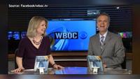
We say farewell to WBOC News anchors Jacqueline and Todd Karli and recap their time here at the station.

site-logo
  • Facebook
  • Twitter
  • LinkedIn
  • YouTube
  • Instagram

Sections

  • Latest Newscasts
  • Local News
  • Weather
  • Features
  • DelmarvaLife
  • Outdoors Delmarva
  • Delmarva Home Show
  • CoastTV
  • Telemundo Delmarva
  • Delmarva Sports Network
  • Video Center

Services

  • Search
  • Pay My Bill
  • Advertise With Us
  • Contact Us
  • Careers
  • Internships

Browser Compatibility

Your browser is out of date and potentially vulnerable to security risks.
We recommend switching to one of the following browsers:

Microsoft Edge Google Chrome Firefox
FCC Public File Applications & Related Materials EEO Public File Report FCC Closed Captioning Concerns Children's Programming Transparency Requirements for Group Health Plans
© Copyright 2025 WBOC TV 1729 N. Salisbury BLVD, Salisbury, MD  | Terms of Use  | Privacy Policy
Powered by BLOX Content Management System from BLOX Digital.