

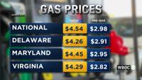
Gas prices continue to climb across Delmarva, with drivers paying well over four dollars a gallon at many stations, and businesses saying they…
From
To

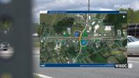
DelDOT provided state leaders with an update on several major road construction projects across the state this week, outlining progress in Ken…


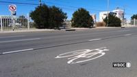
Maryland transportation officials and Ocean City leaders launched the 2026 Walk Smart, Drive Smart, Bike Smart campaign Thursday, urging drive…

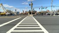
Maryland's Department of Transportation says officials from the department will join Ocean City officials on Thursday, April 30 to launch the 2026 Walk Smart, Drive Smart, Bike Smart campaign.

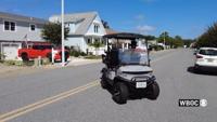
Police are reinforcing a ban on low-speed vehicles within town limits, a reminder that has some residents pushing for a policy change.

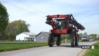
As spring planting season begins, more farm equipment is appearing on local roadways, creating new challenges for both farmers and drivers.

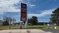
As gas prices hover around or above $4 a gallon across the Eastern Shore, drivers on the Delmarva Peninsula say the rising cost of fuel is for…

Ocean City officials are formally opposing a proposed State Highway Administration pilot project on Philadelphia Avenue, arguing the plan coul…

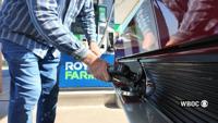
Maryland drivers are feeling the pinch at the pump as gas prices continue to rise, driven in part by ongoing conflict in the Middle East.

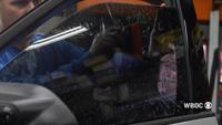
Delaware drivers could soon be allowed to have darker window tint on their vehicles under a new bill introduced in the General Assembly.