


DelmarvaLife's James McDonald hits the town to ask people some challenging Valentine's Day trivia questions.
From
To

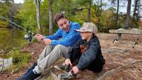
DelmarvaLife's James McDonald tries his hand at fishing with help from a very young expert.

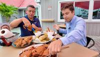
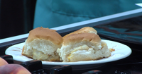
DelmarvaLife's James McDonald heads to Assateague Crab House to discover their bountiful selection of fresh seafood.


DelmarvaLife's James McDonald is joining in on a program from TidalHealth Home Care that's getting seniors active, moving, and hydrated.


The DelmarvaLife family just got bigger, so we are introducing our brand new field correspondent, James McDonald!