

ANNAPOLIS, Md. (AP) - A Maryland panel voted Tuesday to recommend a new congressional map for state lawmakers to consider in a special session next month, with supporters saying it marks an overall improvement on the current map and opponents criticizing it for failing to address gerrymandering.
Four Democrats, including Senate President Bill Ferguson and House Speaker Adrienne Jones, voted for the second option of three maps before them, and two Republicans opposed it.
Democrats on the panel say the recommendation of Map 2 creates more compact and contiguous districts for Maryland’s eight U.S. House seats.
“You're never going to find a perfect map," said Del. Eric Luedtke, a Montgomery County Democrat who is on the panel. "This is a much better map than what we have. I think it responds to the public testimony we got from the citizens of Maryland from our 12 hearings.”
But the two Republicans on the commission say it doesn’t go far enough to address gerrymandering in the current map that has heavily favored Democrats, who hold a 7-1 advantage over Republicans in a state where Democrats outnumber Republicans 2-1.
“A simple glance at this carefully crafted map shows the partisan carving up of counties and communities for political gain,” Republican Sen. Bryan Simonaire said.
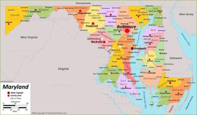
Maryland's 1st Congressional District, which includes the Eastern Shore and is represented by Republican Rep. Andy Harris, was one of the closely watched districts, as observers looked to see whether Democrats in control of the Maryland General Assembly would redraw it in an effort to oust the state's lone GOP congressman.
The map approved by the panel would bring some of Harris' district across the Chesapeake Bay into Anne Arundel County and into an area with more Democrats. However, it does not go as far as another proposed map, which would have extended the district even further into Anne Arundel and cut out Cecil County.
The map also keeps the 4th and 7th Congressional Districts majority-minority districts. The 5th Congressional District in southern Maryland would have a plurality of Black residents, which more accurately reflects the changing demographics of southern Maryland, particularly in Charles County, said Senate President Bill Ferguson, a Baltimore Democrat who is a member of the commission.
The 6th Congressional District in western Maryland will have more of Frederick County than the current map, and the 8th Congressional District will include the inner beltway areas in the suburbs of the nation's capital in Montgomery County, while uniting Carroll and Frederick counties better than the current map, Luedtke said.
The map will be submitted to the Maryland General Assembly, which is scheduled to hold a special session starting Dec. 6 to consider it.
This redistricting cycle in Maryland is unusual, because the state has a Republican governor for the first time during the redistricting process.
Gov. Larry Hogan, who has long been critic of partisan redistricting, appointed a separate commission with nine members, including three Democrats, three Republicans and three independents. Hogan is submitting that commission's proposed map to the Maryland General Assembly.
While Hogan can veto whatever map is approved by state lawmakers, the legislature holds a veto-proof majority and would have the votes override the governor's veto.
