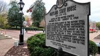
  • Facebook
  • Twitter
  • LinkedIn
  • YouTube
  • Instagram
  • Sign Up
  • Log In
  • Dashboard
  • Logout
    • My Account
    • Dashboard
    • Profile
    • Saved items
    • Logout
Home
  • About WBOC
  • Our Team
  • Programming
  • Contact Us
  • Careers
  • Internships
  • Policies
  • Report It
  • Get our newsletters
  • WBOC Apps
News
  • Wicomico County
  • Worcester County
  • Somerset County
  • Dorchester County
  • Caroline County
  • Talbot County
  • Queen Annes County
  • Sussex County
  • Kent County
  • Accomack County
  • National News
  • International News
  • Latest Newscasts
  • Video Center
Weather
  • Forecast
  • Radar
  • Satellite
  • On The Waters
  • Weather Cameras
  • Closings
Delmarva Sports Network
Shows
  • DelmarvaLife
  • Outdoors Delmarva
  • Delmarva Home Show
Features
  • Travels With Charlie
  • Bless Our Children
  • Proud To Serve
  • The M Report
  • Heartbeat of Delmarva
  • Farming Our Future
  • Farm to Table Scholarship
  • Obituaries
  • Events: DSN Outdoors Expo
Radio
  • 100.9% Classic Country WAAI
  • 107.1 The Duck
  • 102.5 WBOC FM
  • 93.5 The Beach
  • 107.7 BIG Classic Rock
  • 103.9 and 106.3 Coast Country
  • Watch Live
  • Apps
  • Contact Us
  • My Account
  • Sign Up
  • Log In
  • Dashboard
  • Logout
    • My Account
    • Dashboard
    • Profile
    • Saved items
    • Logout
  • Facebook
  • Twitter
  • LinkedIn
  • YouTube
  • Instagram
  • 92° Partly Cloudy
    • Salisbury, MD (21801)

      Today

      Thunderstorms. Potential for severe thunderstorms. Low 73F. SW winds at 10 to 20 mph, decreasing to 5 to 10 mph. Chance of rain 100%. Rainfall near an inch..

      Tonight

      Thunderstorms. Potential for severe thunderstorms. Low 73F. SW winds at 10 to 20 mph, decreasing to 5 to 10 mph. Chance of rain 100%. Rainfall near an inch.

      Updated: July 1, 2025 @ 4:52 pm

    • Full Forecast
site-logo
Watch Live

Newscast Schedule

View Programming Schedule
site-logo
  • 92°
  • Home
  • News
    • Local News
    • National News
    • International News
    • Latest Newscasts
    • Video Center
    • Wicomico County
    • Worcester County
    • Somerset County
    • Dorchester County
    • Caroline County
    • Talbot County
    • Queen Annes County
    • Sussex County
    • Kent County
    • Accomack County
    • Report It
  • Weather
    • Forecast
    • Radar
    • Satellite
    • On The Waters
    • Weather Cameras
    • Closings
  • Delmarva Sports Network
  • Shows
    • DelmarvaLife
    • Outdoors Delmarva
    • Delmarva Home Show
  • Features
    • Heartbeat of Delmarva
    • The M Report
    • Proud To Serve
    • Travels With Charlie
    • Farming Our Future
    • Farm to Table Scholarship
    • Jefferson Awards
    • Obituaries
    • Delmarva Experts
    • Bless Our Children
    • Events: DSN Outdoors Expo
  • Radio
    • 100.9% Classic Country WAAI
    • 107.1 The Duck
    • 93.5 The Beach
    • 107.7 BIG Classic Rock
    • 103.9 and 106.3 Coast Country
    • 102.5 WBOC FM
  • About Us
    • About WBOC
    • Our Team
    • Channel Finder
    • Apps
    • Contact Us
    • Get our newsletters
    • Careers
    • Internships
    • Policies
    • WBOC Solar Farm
Broadcast Schedule

On air schedule

Weather Alert

Weather Alert

The National Weather Service in Wakefield has issued a

* Severe Thunderstorm Warning for...
Northwestern Wicomico County in southeastern Maryland...
Dorchester County in southeastern Maryland...

* Until 545 PM EDT.

* At 453 PM EDT, a severe thunderstorm was located 10 miles south of
Cambridge, moving northeast at 30 mph.

HAZARD...60 mph wind gusts.

SOURCE...Radar indicated.

IMPACT...Expect damage to trees and powerlines.

* This severe thunderstorm will be near...
Vienna around 510 PM EDT.
Sharptown around 525 PM EDT.

Other locations impacted by this severe thunderstorm include
Galestown, Mardela Springs, Brookview, Eldorado, Woolford, East New
Market, Church Creek, Bucktown, and Linkwood.

PRECAUTIONARY/PREPAREDNESS ACTIONS...

For your protection move to an interior room on the lowest floor of a
building.

Please report severe weather by calling 757-899-2415, posting to the
NWS Wakefield Facebook page, or using X @NWSWAKEFIELDVA.

&&


HAIL THREAT...RADAR INDICATED;
MAX HAIL SIZE...<.75 IN;
WIND THREAT...RADAR INDICATED;
MAX WIND GUST...60 MPH

Weather Alert

...A SPECIAL MARINE WARNING REMAINS IN EFFECT UNTIL 515 PM EDT...

For the following areas...
Chesapeake Bay from Drum Point MD to Smith Point VA...
Chesapeake Bay from North Beach to Drum Point MD...
Tangier Sound and the inland waters surrounding Bloodsworth Island...
Tidal Potomac from Cobb Island MD to Smith Point VA...

At 441 PM EDT, a strong thunderstorm was located over Yeocomico
River, moving northeast at 15 knots.

HAZARD...Wind gusts 34 knots or greater.

SOURCE...Radar indicated.

IMPACT...Boaters in small craft could be thrown overboard by
suddenly higher winds and waves capsizing their vessel.

Locations impacted include...
Point Lookout, Hooper Island Light, Piney Point, Saint George Island,
Point No Point, Honga River, The Targets, Richland Point Buoy, and
Tall Timbers.

PRECAUTIONARY/PREPAREDNESS ACTIONS...

Move to safe harbor until hazardous weather passes.

Frequent lightning is occurring with this storm. If caught on the
open water stay below deck if possible, keep away from ungrounded
metal objects.

&&


HAIL...0.00IN;
WIND...>34KTS

Weather Alert

THE NATIONAL WEATHER SERVICE HAS ISSUED SEVERE THUNDERSTORM WATCH
481 IN EFFECT UNTIL 9 PM EDT THIS EVENING FOR THE FOLLOWING AREAS

IN MARYLAND THIS WATCH INCLUDES 4 COUNTIES

IN SOUTHEAST MARYLAND

DORCHESTER            SOMERSET              WICOMICO
WORCESTER

IN VIRGINIA THIS WATCH INCLUDES 20 COUNTIES

IN CENTRAL VIRGINIA

AMELIA                CHESTERFIELD          CITY OF RICHMOND
CUMBERLAND            FLUVANNA              GOOCHLAND
HANOVER               HENRICO               LOUISA
POWHATAN

IN EAST CENTRAL VIRGINIA

ESSEX                 KING WILLIAM          KING AND QUEEN
NEW KENT              RICHMOND              WESTMORELAND

IN EASTERN VIRGINIA

LANCASTER             MIDDLESEX             NORTHUMBERLAND

IN NORTH CENTRAL VIRGINIA

CAROLINE

THIS INCLUDES THE CITIES OF AMELIA COURTHOUSE, ANGOLA, BEACH,
BON AIR, BOTTOMS BRIDGE, BRAYS FORK, BROWNS CORNER,
BURRUSS CORNER, CAMBRIDGE, CARET, CEDAR FORK, CENTER CROSS,
CHAMPLAIN, CHESTER, CHESTERFIELD, CHULA, CLANCIE, COLONIAL BEACH,
CORBIN, CRISFIELD, DAWN, DENARO, DRAGONVILLE, DUNBROOKE,
DUNNSVILLE, EARLS, GLEN ALLEN, GOOCHLAND, GRESSIT, GUINEA MILLS,
HAWK, HOWERTONS, JETERSVILLE, KILMARNOCK,
KING AND QUEEN COURT HOUSE, LAKE MONTICELLO, LANCASTER,
LEWISETTA, LITTLE PLYMOUTH, LOUISA, MANNBORO, MASCOT, MATTAPONI,
MEADOWVILLE, MECHANICSVILLE, MIDLOTHIAN, MINERAL, MOSELEY,
MOUNTCASTLE, NEW KENT AIRPORT, OCEAN CITY, ORAPAX FARMS,
POWHATAN, PRINCESS ANNE, QUINTON, RAINES TAVERN, REEDS, RICHMOND,
SALISBURY, SANDSTON, SCOTTS FORK, STODDERT, TALLEYSVILLE,
URBANNA, WARSAW, AND WEST POINT.

Weather Alert

THE NATIONAL WEATHER SERVICE HAS ISSUED SEVERE THUNDERSTORM WATCH
481 IN EFFECT UNTIL 9 PM EDT THIS EVENING FOR THE FOLLOWING AREAS

THIS WATCH INCLUDES THE FOLLOWING ADJACENT COASTAL WATERS

CHESAPEAKE BAY NORTH OF POOLES ISLAND MD
CHESAPEAKE BAY FROM POOLES ISLAND TO SANDY POINT MD

CHESAPEAKE BAY FROM SANDY POINT TO NORTH BEACH MD

CHESAPEAKE BAY FROM NORTH BEACH TO DRUM POINT MD

CHESAPEAKE BAY FROM DRUM POINT MD TO SMITH POINT VA

TIDAL POTOMAC FROM KEY BRIDGE TO INDIAN HEAD MD

TIDAL POTOMAC FROM INDIAN HEAD TO COBB ISLAND MD

TIDAL POTOMAC FROM COBB ISLAND MD TO SMITH POINT VA

PATAPSCO RIVER INCLUDING BALTIMORE HARBOR
CHESTER RIVER TO QUEENSTOWN MD
EASTERN BAY
CHOPTANK RIVER TO CAMBRIDGE MD AND THE LITTLE CHOPTANK RIVER

PATUXENT RIVER TO BROOMES ISLAND MD
TANGIER SOUND AND THE INLAND WATERS SURROUNDING BLOODSWORTH
ISLAND

Weather Alert

...SMALL CRAFT ADVISORY IN EFFECT UNTIL 6 AM EDT WEDNESDAY...

* WHAT...Southwest winds 10 to 15 kt with gusts up to 25 kt.

* WHERE...Chesapeake Bay from Drum Point MD to Smith Point VA,
Tidal Potomac from Cobb Island MD to Smith Point VA and
Tangier Sound and the inland waters surrounding Bloodsworth
Island.

* WHEN...Until 6 AM EDT Wednesday.

* IMPACTS...Conditions will be hazardous to small craft.

PRECAUTIONARY/PREPAREDNESS ACTIONS...

Inexperienced mariners, especially those operating smaller
vessels, should avoid navigating in hazardous conditions.

&&

Advanced Search Close Search
From
To
Close Search
1:59
A Fiery End To A Meeting In Worcester County
Latest News

A Fiery End To A Meeting In Worcester County

  • Kyle Orens
  • Updated May 19, 2025

BERLIN, Md. -- At Berlin's most recent council meeting, a heated debate unfolded during the public comment section. It centered around the property value of a local Dollar General store. 

3:44
Taking A Deeper Dive Into The Proposed Agreement Between US Wind And Maryland
Latest News

Taking A Deeper Dive Into The Proposed Agreement Between US Wind And Maryland

  • Kyle Orens
  • Updated May 15, 2025

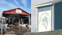
WORCESTER COUNTY, Md. -- On Wednesday, we reported about a proposed $20 million investment from US Wind to support the local fishing community. Another development from that news is the offshore wind company's plans for two properties in the West Ocean City Harbor. 

site-logo
  • Facebook
  • Twitter
  • LinkedIn
  • YouTube
  • Instagram

Sections

  • Latest Newscasts
  • Local News
  • Weather
  • Features
  • DelmarvaLife
  • Outdoors Delmarva
  • Delmarva Home Show
  • CoastTV
  • Telemundo Delmarva
  • Delmarva Sports Network
  • Video Center

Services

  • Search
  • Pay My Bill
  • Advertise With Us
  • Contact Us
  • Careers
  • Internships

Browser Compatibility

Your browser is out of date and potentially vulnerable to security risks.
We recommend switching to one of the following browsers:

Microsoft Edge Google Chrome Firefox
FCC Public File Applications & Related Materials EEO Public File Report FCC Closed Captioning Concerns Children's Programming Transparency Requirements for Group Health Plans
© Copyright 2025 WBOC TV 1729 N. Salisbury BLVD, Salisbury, MD  | Terms of Use  | Privacy Policy
Powered by BLOX Content Management System from BLOX Digital.