Sussex County is moving forward with plans to build a new emergency medical services station in Lincoln, a project local residents and first responders say will help meet the growing demand for emergency care in the area.
Sussex County is moving forward with plans to build a new emergency medical services station in Lincoln, a project local residents and first responders say will help meet the growing demand for emergency care in the area.
Kent County officials broke ground at two future EMS facilities Tuesday morning. Public safety officials said the new facilities hope to improve coverage and response times in the area.
A Friday morning fire in the Sherwood Forest development was ruled accidental, according to the Indian River Volunteer Fire Company.

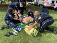
The Sussex County Emergency Medical Services was recently recognized by the Society for Simulation in Healthcare (SSH) for its educational training programs – the first EMS agency ever to earn the distinction.