

One of those preparations was the annual vet check on Tuesday morning. At the check, veterinarians assess whether or not each horse is healthy…
From
To

The Chincoteague Volunteer Fire Company saw record bidding at Thursday’s pony auction following the 99th Annual Chincoteague Pony Swim.

The Chincoteague Volunteer Fire Company saw record bidding at Thursday’s pony auction following the 99th Annual Chincoteague Pony Swim.


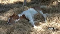
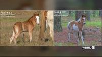
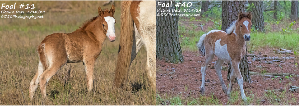
The Chincoteague Volunteer Fire Company has shared sad news of the loss of three foals ahead of their annual Pony Penning in July.

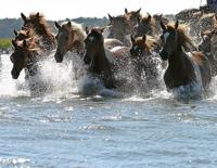
Every year, thousands of spectators flock to Chincoteague to watch the annual Pony Swim. For those unfamiliar with the Pony […]