


Forecast Updated on Friday, August 25, 2023, at 3:50am by WBOC Meteorologist Mike Lichniak
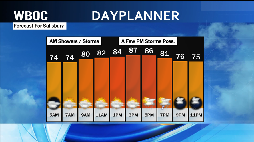
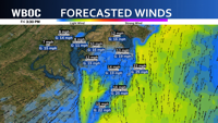
Today: Partly to mostly cloudy with on and off showers / storms. Highs: 82-92. Winds: SW-NW 5-20+ mph.
Tonight: A few storms possible early. It will turn partly cloudy to mostly clear by morning. Lows: 70-75. Winds: SW-W 5-15 mph.
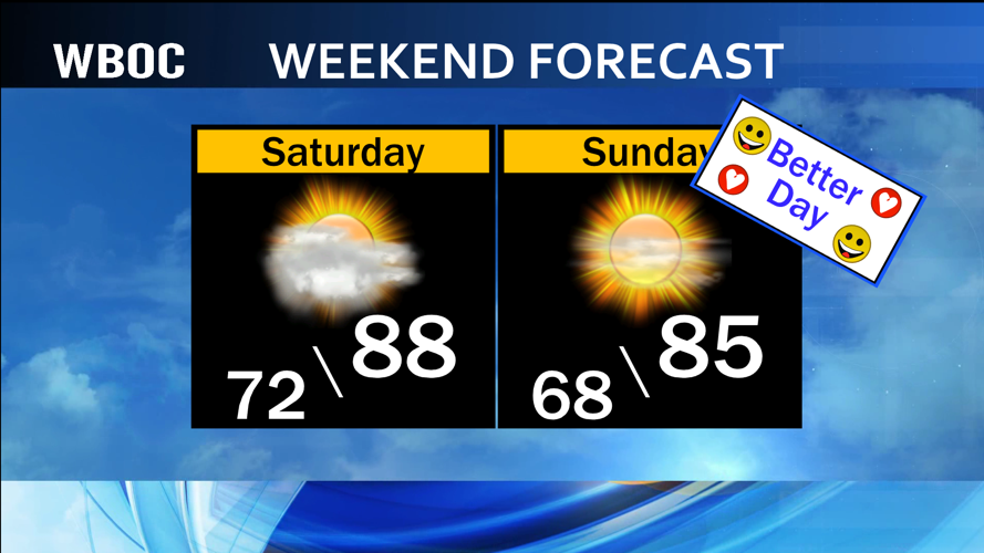
Saturday: Partly to mostly sunny with a chance of a pop-up shower or storm. Highs: 84-90. Winds: W-NW 5-20+ mph.
Saturday Night: Turning mostly clear. Lows: 64-73. Winds: NW 5-15 mph.
Sunday: Partly to mostly sunny. Highs: 80-86. Winds: N 5-15 mph.
Monday: Partly to mostly cloudy with scattered showers possible throughout the day. Highs: 80-85. Winds: NE 5-15 mph.

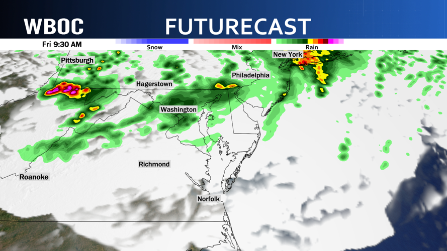
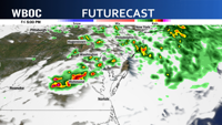
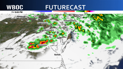
Watching a line of showers and storms diving toward Delmarva from the north and west early this morning will bring our first chance of some scattered showers and thunderstorms through the morning commute. Some of these storms could bring lots of rain and lightning and some stronger wind gusts.


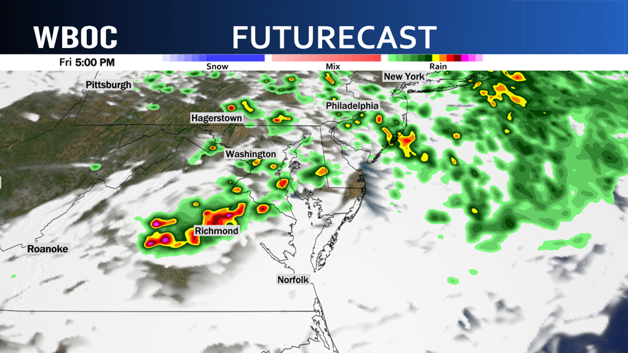
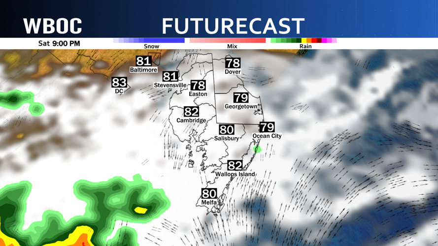
The front that will provide us this initial chance of storms this morning will start to slow down and will keep the chance of a few scattered showers / storms into the forecast later this afternoon and this evening. The front should clear the region on Friday night and we should see a slow clearing to the region by the time we wake up on Saturday morning.

The front will stall out to our south and will be close enough that we can’t rule out the chance of a pop-up shower or storm on Saturday. This chance is looking very low for the Peninsula with better chances for showers and storms across Hampton Roads and eastern North Carolina.

The front will wash out by Sunday and provide us with a really nice day before another unsettled pattern sets up for early next week with shower chances for Monday and especially on Tuesday.

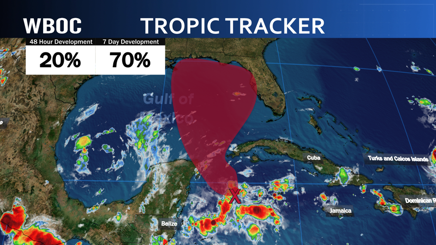
The high pressure sitting to our west will become a very important piece of the puzzle heading into next week as the tropics have exploded with activity in the last 48 hours. We will be watching one of the storms in particular as Franklin has been projected by the models to take a path where we may have to deal with the swell and waves off the open Atlantic as the storm is going to pass between us and Bermuda by Tuesday.

We will also watch the Gulf of Mexico as it does look like another tropical system will form there over the weekend and could make landfall in Florida early next week with some of the remnant moisture bringing more rain and storm chances by Wednesday and early on Thursday.