


DELMARVA PENINSULA - Severe thunderstorms hit Delmarva with a one-two punch on Friday.
A slow-moving severe thunderstorm over Sussex County triggered a tornado warning early Friday afternoon. Heavy rain, hail, and frequent lightning lashed communities such as Millsboro, Selbyville, Fenwick Island, and even into Ocean City. But this was just a preview of what was to come.
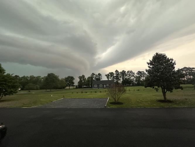
Just after 5 p.m., a severe thunderstorm rolled ashore in Queen Anne's County, near Romancoke, Md.

Photo: Michele Baker, Delmar

Viewer Photo: Hebron, MD
A series of severe thunderstorms over western Maryland and northern Virginia then joined together to form a continuous like of severe thunderstorms that stretched from Cecil County, Md. all the way to Accomack County, Va.
By 6:30 p.m., nearly all of Delmarva was under severe thunderstorm warnings that were classified as "Considerable" or "Destructive." A Considerable warning is issued for storms with 70+ mph wind gusts and/or golf ball side hail. Destructive warnings are issued for 80+ mph wind gusts and baseball size hail.

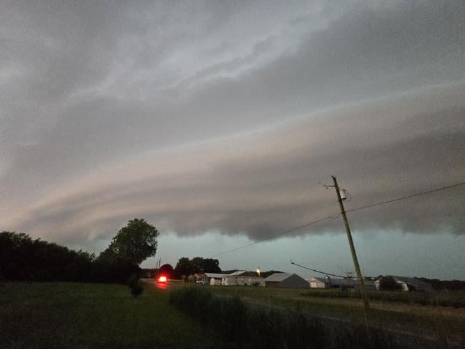
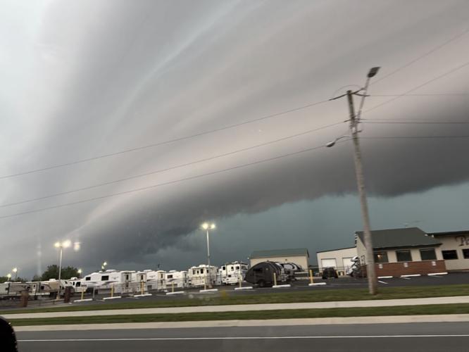
Photo: Justin Dorsey, Hurlock, MD
Radar indicated tennis ball-sized hail near Easton, Md. Damaging winds, frequent lightning and torrential downpours were also observed on radar. Nearly 2 inches of rain fell near Easton, Md.

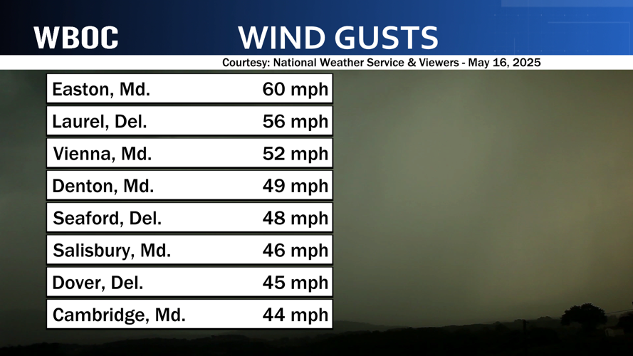
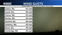
Some of the highest wind gusts reported May 16, 2025 over Delmarva.

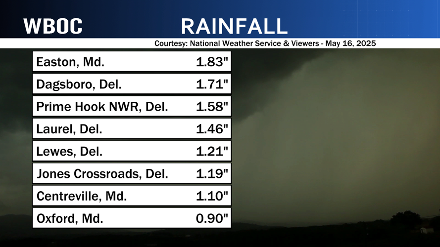
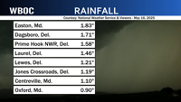
Some of the heaviest rain reported May 16, 2025 over Delmarva.
Shortly before 7 p.m., a severe thunderstorm developed a rotation that triggered a tornado warning for parts of Dorchester, Caroline, Wicomico, and Sussex Counties.
The storms departed Delmarva just after 8 p.m.
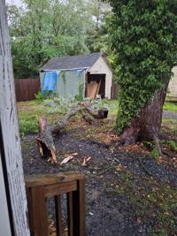
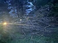
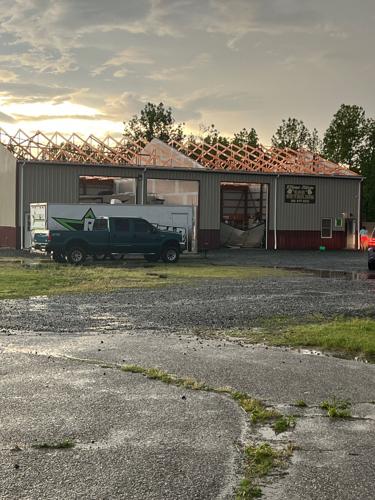
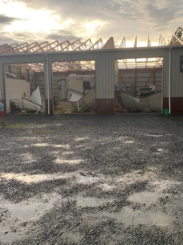
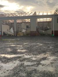
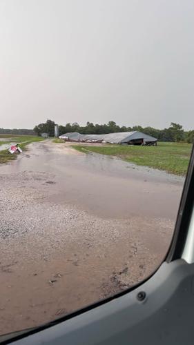
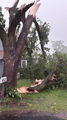
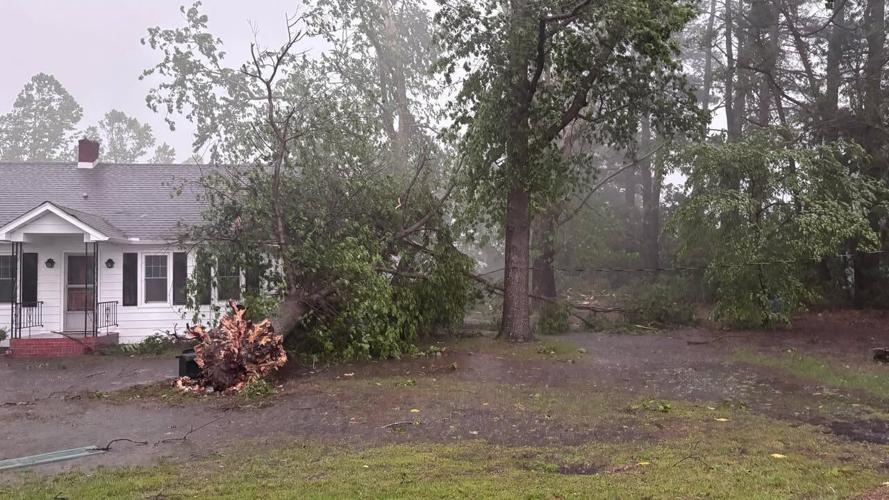
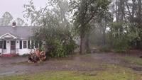
There were reports of numerous trees and powerlines down in Easton and Denton, Md., including two trees on homes in Easton.

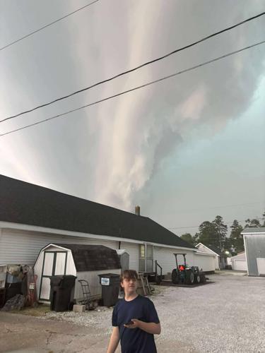
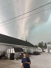
Photo: Nicole Hickaman, Laurel

Photo: Rachel Elliot, Salisbury
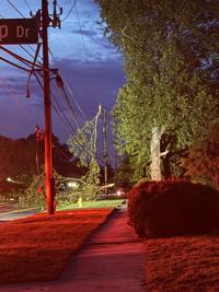
The same part of the storm also brought down numerous trees and closed part of Route 493 near Bethel, Del.
By 8:30 p.m., Delmarva Power reported more than 8,300 customers without power across their service area.

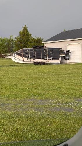
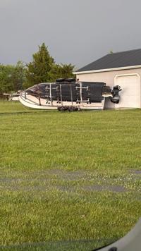
Photo: Jeff Wigle, Rhodesdale, MD

Photo: Avalon Bristow, Smyrna
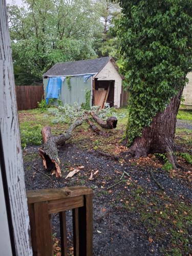
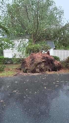
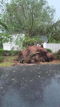
There was damage reported throughout the night by WBOC viewers in areas across Delmarva including in Laurel, Delaware and Salisbury and Galestown in Maryland.

Photo: Michael Willey, Laurel, DE

Photo: Michael Willey, Laurel, DE

Photo: Billy Hudson, Galestown, MD

Photo: Billy Hudson, Galestown, MD

Photo: Billy Hudson, Galestown, MD

Photo: Jennifer Blohm, Salisbury, MD
More strong storms are possible early Saturday morning.


