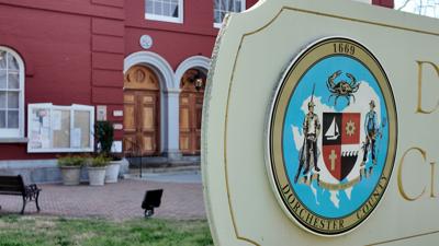
Other Counties
- $212,980 for electronic poll book replacements
- $7,043 for T1 Connection-MD Network, DOIT Services and STO Finance
- $73,572 for Voting machine accessories and lease
Thunderstorms during the evening will give way to mainly clear skies after midnight. A few storms may be severe. Low near 60F. Winds NNW at 10 to 20 mph. Chance of rain 100%..
Thunderstorms during the evening will give way to mainly clear skies after midnight. A few storms may be severe. Low near 60F. Winds NNW at 10 to 20 mph. Chance of rain 100%.
Updated: June 23, 2026 @ 4:08 pm
...SMALL CRAFT ADVISORY REMAINS IN EFFECT UNTIL 11 AM EDT WEDNESDAY... * WHAT...North winds 10 to 20 kt with gusts up to 30 kt. * WHERE...Chesapeake Bay from Pooles Island MD to Smith Point VA, Tidal Potomac from Cobb Island MD to Smith Point VA, Chester River to Queenstown MD, Eastern Bay, Choptank River to Cambridge MD and the Little Choptank River, and Tangier Sound and the inland waters surrounding Bloodsworth Island. * WHEN...Until 11 AM EDT Wednesday. * IMPACTS...Conditions will be hazardous to small craft. PRECAUTIONARY/PREPAREDNESS ACTIONS... Inexperienced mariners, especially those operating smaller vessels, should avoid navigating in hazardous conditions. &&
SEVERE THUNDERSTORM WATCH 381 REMAINS VALID UNTIL 8 PM EDT THIS EVENING FOR THE FOLLOWING AREAS THIS WATCH INCLUDES THE FOLLOWING ADJACENT COASTAL WATERS CHESAPEAKE BAY FROM DRUM POINT MD TO SMITH POINT VA PATUXENT RIVER TO BROOMES ISLAND MD TANGIER SOUND AND THE INLAND WATERS SURROUNDING BLOODSWORTH ISLAND
...FLOOD WATCH REMAINS IN EFFECT UNTIL 10 PM EDT THIS EVENING... * WHAT...Flooding caused by excessive rainfall continues to be possible. * WHERE...Portions of southeast Maryland, including the following areas, Inland Worcester, Somerset and Wicomico and Virginia, including the following areas, Accomack, Chesapeake, Gloucester, Hampton/Poquoson, Isle of Wight, James City, Lancaster, Mathews, Middlesex, Newport News, Norfolk, Northampton, Northumberland, Portsmouth, Southampton, Suffolk, Surry, Sussex, Virginia Beach and York. * WHEN...Until 10 PM EDT this evening. * IMPACTS...Excessive runoff may result in flooding of rivers, creeks, streams, and other low-lying and flood-prone locations. Flooding may occur in poor drainage and urban areas. * ADDITIONAL DETAILS... - Thunderstorms containing heavy rain are expected through early evening. Rainfall rates may exceed 2 inches per hour at times. - http://www.weather.gov/safety/flood PRECAUTIONARY/PREPAREDNESS ACTIONS... You should monitor later forecasts and be alert for possible Flood Warnings. Those living in areas prone to flooding should be prepared to take action should flooding develop. &&
SEVERE THUNDERSTORM WATCH 381 REMAINS VALID UNTIL 8 PM EDT THIS EVENING FOR THE FOLLOWING AREAS IN MARYLAND THIS WATCH INCLUDES 4 COUNTIES IN SOUTHEAST MARYLAND DORCHESTER SOMERSET WICOMICO WORCESTER IN NORTH CAROLINA THIS WATCH INCLUDES 9 COUNTIES IN NORTHEAST NORTH CAROLINA BERTIE CAMDEN CHOWAN CURRITUCK GATES HERTFORD NORTHAMPTON PASQUOTANK PERQUIMANS IN VIRGINIA THIS WATCH INCLUDES 23 COUNTIES IN EASTERN VIRGINIA MATHEWS MIDDLESEX NORTHAMPTON IN SOUTHEAST VIRGINIA ACCOMACK CITY OF CHESAPEAKE CITY OF EMPORIA CITY OF FRANKLIN CITY OF HAMPTON CITY OF NEWPORT NEWS CITY OF NORFOLK CITY OF POQUOSON CITY OF PORTSMOUTH CITY OF SUFFOLK CITY OF VIRGINIA BEACH CITY OF WILLIAMSBURG GLOUCESTER GREENSVILLE ISLE OF WIGHT JAMES CITY SOUTHAMPTON SURRY SUSSEX YORK THIS INCLUDES THE CITIES OF AHOSKIE, BACONS CASTLE, BARHAM, BAVON, BOOTH FORK, BOWERS HILL, BOYKINS, BRYANTOWN, BUFFORD CROSSROADS, BUSCH GARDENS, CAMBRIDGE, CAPE CHARLES, CAPE COLONY, CENTERVILLE, CHESAPEAKE AIRPORT, CHINCOTEAGUE, CHIPPOKES STATE PARK, CHRISTENSONS CORNER, CLARESVILLE, COURTLAND, COWIE CORNER, CRISFIELD, CROAKER, CURRITUCK, DEEP CREEK, DURAND, EAGLETOWN, EDENHOUSE, EDENTON, ELIZABETH CITY, EMPORIA, EMPORIA AIRPORT, EMPORIA RESERVOIR, EWELL, EXMORE, FENTRESS, FIVE FORKS, FRANKLIN, GARYSBURG, GASTON, GATESVILLE, GLOUCESTER POINT, GREAT BRIDGE, GREEN PLAIN, GREENBACKVILLE, GREENBRIER, GROVE, GUM FORKS, GWALTNEY CORNER, HAMPTON, HANCOCK, HERTFORD, HOG ISLAND GAME RESERVE, HORNTOWN, HORSESHOE, HUNTERDALE, IVOR, LILLY, MACEDONIA, MAVATON, MERRY HILL, MIDWAY, MOUNT PLEASANT, NEW CHURCH, NEW POINT, NEW POINT COMFORT, NEWPORT NEWS, NORFOLK, OCEAN CITY, ONANCOCK, PEARY, POOLESVILLE, POQUOSON, PORTSMOUTH, PRINCESS ANNE, QUITSNA, RICH SQUARE, SAINT JOHNS, SALISBURY, SHARON, SMITHFIELD, SUFFOLK, URBANNA, VALHALLA, VIRGINIA BEACH, VULTARE, WAKEFIELD, WAVERLY, WILLIAMSBURG, WINDSOR, AND YORKTOWN.
Video Journalist
Kyle Orens has been a video journalist with WBOC since September of 2022. After graduating from the University of South Carolina, he promptly returned to his hometown state of Maryland and now covers stories in Worcester County. You can see him all over the peninsula though, and whether he's working or out adventuring with his dog Bridger, always feel free to say hello.
{{description}}
Email notifications are only sent once a day, and only if there are new matching items.
Not home to watch today's news? Sign up for WBOC's daily headlines to keep up with the latest across Delmarva, sent straight to your inbox.
Success! An email has been sent to with a link to confirm list signup.
Error! There was an error processing your request.