

Forecast Updated on Wednesday, February 16, 2022, at 3:30am by WBOC Meteorologist Mike Lichniak
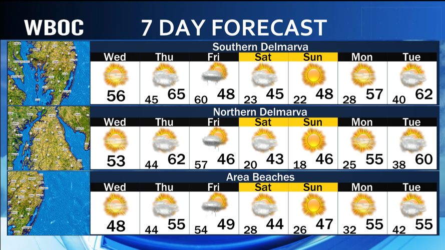
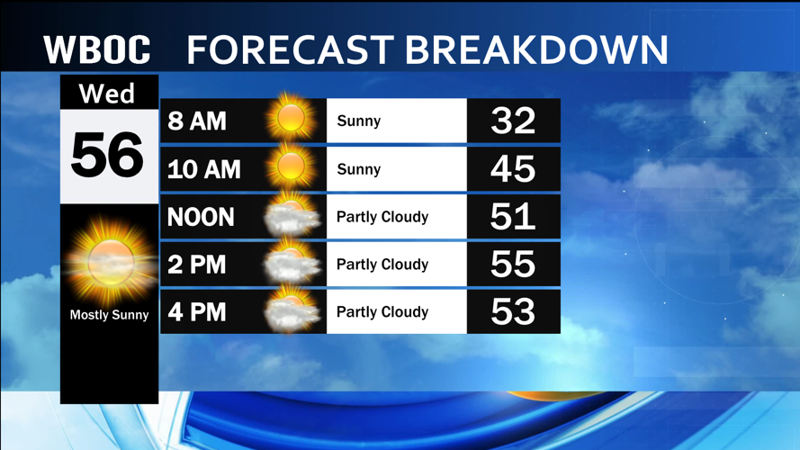
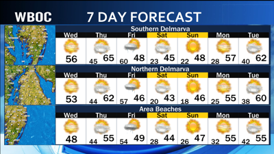
Today: Mostly sunny and warmer! Highs: 50-58. Winds: SE-S 5-15 mph.
Tonight: Partly cloudy and breezy. Lows: 42-48. Winds: S 5-20+ mph.
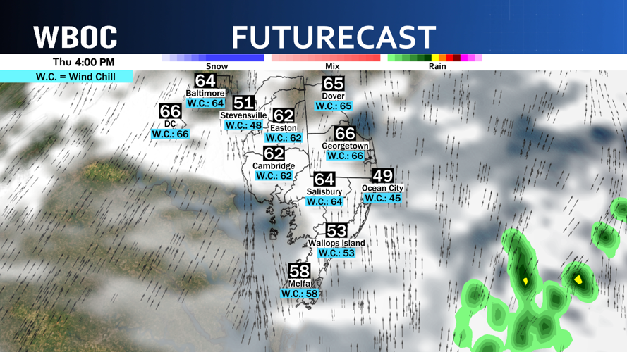
Thursday: Partly to mostly cloudy and warm. Windy. Highs: 62-68. Winds: SW 10-35+ mph.
Thursday Night: Mostly cloudy with scattered showers and thunderstorms possible. Windy. Lows: 58-65. Winds: SW-NW 15-40+ mph.
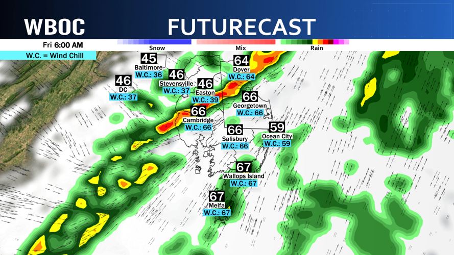
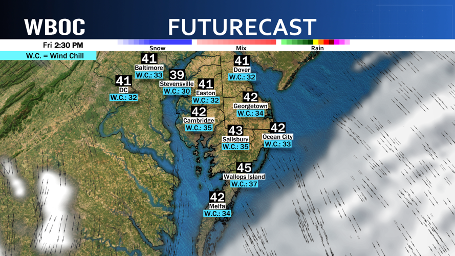
Friday: Showers linger early in the morning, otherwise it is partly cloudy and windy. Highs: 57-63 early, temperatures fall all day long. Winds: NW 15-40+ mph.
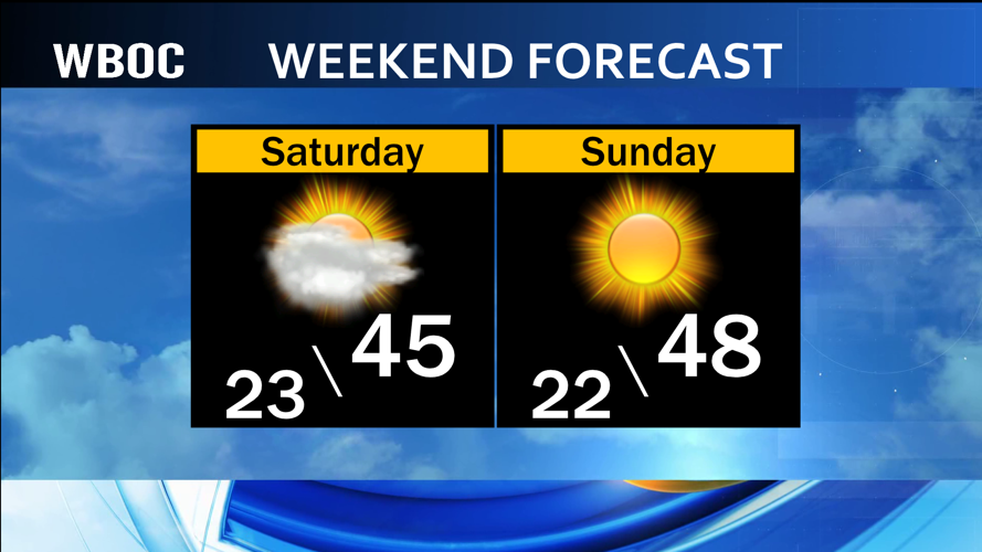
Saturday: Partly to mostly sunny and breezy. Highs: 40-46. Winds: NW 10-25+ mph.
The high pressure that has been overhead the last couple of days is now heading out to sea and will settle to our east for a couple of days. This will turn our winds out of the south and southwest and push very warm air onto Delmarva.

After a cool start this morning with temperatures in the 20s across the region, the overdrive kicks in today as highs climb up into the 50s with the breeze out of the southeast and a good amount of sunshine expected.
As the wind continues to turn more out of the west by tonight into Thursday, a bigger surge of warmer temperatures will be noticed. As the clouds start to increase all night long, temperatures will only fall back into the 40s and 50s for morning temperatures on Thursday.

Highs on Thursday will be in the 60s and any sunshine we see between the clouds on Thursday could help a few of us take a run at 70 degrees.

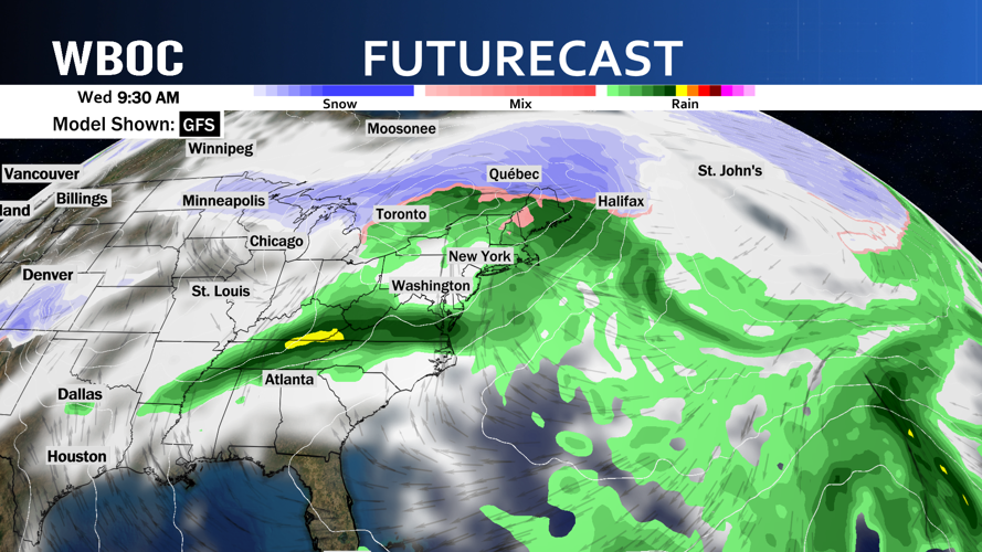
The cold front arrives late Thursday night and into Friday and will bring with it a shot of scattered showers and thunderstorms. The rain chance could linger into the first part of Friday as the cold front clears the region. At this point, we are looking at picking up on about half an inch of rain overall across Delmarva by the time the rain tapers off early on Friday.

The wind turns on Friday evening and ushers in some colder air, but nowhere near as cold as the start of this week. You will notice the difference by Friday evening as temperatures will have fallen from the 60s in the morning into the 30s and 40s by after dinner time and that is not even including the wind chill values. The breeze overnight will keep temperatures in the 20s and 30s and will lead to highs in the 40s on Saturday with a few clouds dotting the sky.

High pressure settles again overhead on Sunday leading to highs in the 40s to near 50 degrees with lots of sunshine. We will keep the sunshine for Monday before a warm and unsettled weather pattern establishes for most of next week.

Temperatures will climb up into the 50s and 60s next week but will have rounds of shower chances coming with the warmer weather.
