
Forecast updated on Thursday, June 22, 2023, at 5:00 PM by WBOC Meteorologist Dan Satterfield (AMS-CBM).
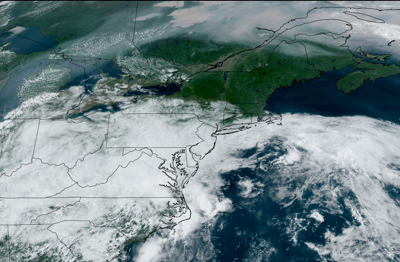
SYNOPSIS: We have more rain on the way tonight and Friday but a warm front will pass and the weekend will feel more like summer. Another summer cool front will arrive by next Tuesday.
DELMARVA FORECAST
RIP CURRENT RISK IS HIGH ON ALL ATLANTIC BEACHES
Tonight: Mostly cloudy and humid. Passing showers and a few downpours possible. Low 66° Wind: SE 6-14 mph.
Friday: Mostly cloudy, warmer and humid. Scattered showers and thunderstorms. Some heavy downpours are likely. High 81° inland and 73° on the beaches. Wind: S 11-22+ mph.
Friday Night: Mostly cloudy with some showers lingering. Low 69-70° Wind: S 4-9 mph.
Saturday: Partly sunny, warmer and quite humid. Scattered PM showers and thunderstorms. Some heavy downpours are likely. High 84° inland and 76° on the beaches. Wind: SW 7-14 mph.
Forecast Discussion:
We will see cloudy skies tonight, with a south wind as a low pressure system drifts closer to the area and weakens. Periods of rain are possible with some passing showers, but some will be heavy. Look for lows temps. near sunrise around 66 degrees. The winds will be much lighter tonight.
A weak warm front is passing through the area, and it will turn warmer and more humid Friday. Look for widely scattered afternoon and evening storms around, and some may be heavy. It will feel like June with muggy air, but a sea breeze will keep the coastal areas in the mid 70's. Inland the temperatures will reach the low 80's. Winds will gust to near 22 mph on the coast, with winds inland at 11-22 mph.
Saturday will be warm and humid with a south breeze and still a decent risk of a passing shower or heavier thunderstorm, mainly in the afternoon.. It will feel like June with muggy air, but a sea breeze will keep the coastal areas in the mid 70's. Inland the temperatures will reach the mid 80's. Winds will gust to near 16 mph on the coast, with winds inland at 7-14 mph.
In the long range: Look for sunshine with scattered afternoon and evening showers Sunday, with afternoon temps. in the mid 80's. It will be a humid, late June style weekend. Thundershowers are possible Monday and it will be warmer and humid, with temps. near 88°. A cool front will bring thunderstorms Tuesday with temps. in the mid 80's but it will cool Wednesday to the low 80's with lower humidity.
The average low for early June is 65°, with a high temp. of 85°.
