  • Facebook
  • Twitter
  • LinkedIn
  • YouTube
  • Instagram
  • Sign Up
  • Log In
  • Dashboard
  • Logout
    • My Account
    • Dashboard
    • Profile
    • Saved items
    • Logout
Home
  • About WBOC
  • Our Team
  • Programming
  • Contact Us
  • Careers
  • Internships
  • Policies
  • Report It
  • Get our newsletters
  • WBOC Apps
News
  • Wicomico County
  • Worcester County
  • Somerset County
  • Dorchester County
  • Caroline County
  • Talbot County
  • Queen Annes County
  • Sussex County
  • Kent County
  • Accomack County
  • National News
  • International News
  • Latest Newscasts
  • Video Center
Weather
  • Forecast
  • Radar
  • Satellite
  • On The Waters
  • Weather Cameras
  • Closings
Delmarva Sports Network
Shows
  • DelmarvaLife
  • Outdoors Delmarva
  • Delmarva Home Show
Features
  • Bless Our Children
  • Holiday House
  • Obituaries
  • Heartbeat of Delmarva
  • Proud To Serve
  • The M Report
  • Farming Our Future
  • Farm to Table Scholarship
  • Events: Job Fair
Radio
  • WDEL
  • 100.9% Classic Country
  • 107.1 The Duck
  • 102.5 WBOC FM
  • 93.5 The Beach
  • 107.7 BIG Classic Rock
  • 103.9 & 106.3 Coast Country
  • 93.7 WSTW
  • WXCY 103.7 & 96.9
  • WCEI 96.7
  • 94.3 Dockside
  • Watch Live
  • Apps
  • Contact Us
  • My Account
  • Sign Up
  • Log In
  • Dashboard
  • Logout
    • My Account
    • Dashboard
    • Profile
    • Saved items
    • Logout
  • Facebook
  • Twitter
  • LinkedIn
  • YouTube
  • Instagram
  • 21° Mostly Cloudy
    • Salisbury, MD (21801)

      Today

      Periods of light snow. High 22F. Winds N at 10 to 20 mph. Chance of snow 40%..

      Tonight

      Overcast. A few flurries or snow showers possible. Low 14F. Winds N at 15 to 25 mph.

      Updated: January 31, 2026 @ 2:41 pm

    • Full Forecast
site-logo
Watch Live

Newscast Schedule

View Programming Schedule
site-logo
  • 21°
  • Home
  • News
    • Wicomico County
    • Worcester County
    • Somerset County
    • Dorchester County
    • Caroline County
    • Talbot County
    • Queen Anne's County
    • Sussex County
    • Kent County
    • Accomack County
    • National News
    • International News
    • Latest Newscasts
    • Video Center
    • Report It
  • Weather
    • Forecast
    • Radar
    • Satellite
    • On The Waters
    • Weather Cameras
    • Closings
  • Delmarva Sports Network
  • Shows
    • DelmarvaLife
    • Outdoors Delmarva
    • Delmarva Home Show
  • Features
    • Bless Our Children
    • Holiday House
    • Obituaries
    • Heartbeat of Delmarva
    • The M Report
    • Proud To Serve
    • Farming Our Future
    • Farm to Table Scholarship
    • Jefferson Awards
    • Delmarva Experts
    • Events: Job Fair
  • Radio
    • WDEL
    • 100.9% Classic Country
    • 107.1 The Duck
    • 93.5 The Beach
    • 107.7 BIG Classic Rock
    • 103.9 & 106.3 Coast Country
    • 102.5 WBOC FM
    • 93.7 WSTW
    • WXCY 103.7 & 96.9
    • WCEI 96.7
    • 94.3 WINX
  • About Us
    • About WBOC
    • Our Team
    • Channel Finder
    • Apps
    • Contact Us
    • Get our newsletters
    • Careers
    • Internships
    • Policies
    • WBOC Solar Farm
  • Report It

WINTER STORM

Download Weather App

Broadcast Schedule

On air schedule

Weather Alert

Weather Alert

...COLD WEATHER ADVISORY REMAINS IN EFFECT UNTIL 10 AM EST SUNDAY...
...WIND ADVISORY REMAINS IN EFFECT FROM 10 PM THIS EVENING TO 4 PM
EST SUNDAY...

* WHAT...For the Cold Weather Advisory, very cold wind chills as low
as 3 below expected. For the Wind Advisory, north winds 20 to 30
mph with gusts up to 50 mph expected.

* WHERE...Inland Worcester, Maryland Beaches, Somerset, and Wicomico
Counties.

* WHEN...For the first Cold Weather Advisory, second Cold Weather
Advisory, and third Cold Weather Advisory, until 10 AM EST Sunday.
For the Wind Advisory, from 10 PM this evening to 4 PM EST Sunday.

* IMPACTS...Gusty winds will blow around unsecured objects. Tree
limbs could be blown down and a few power outages may result. The
cold wind chills as low as 5 below zero could result in
hypothermia if precautions are not taken.

PRECAUTIONARY/PREPAREDNESS ACTIONS...

Winds this strong can make driving difficult, especially for high
profile vehicles. Use extra caution.

Use caution while traveling outside. Wear appropriate clothing, a
hat, and gloves.

&&

Weather Alert

...SMALL CRAFT ADVISORY REMAINS IN EFFECT UNTIL 6 PM EST THIS
EVENING...
...GALE WARNING REMAINS IN EFFECT FROM 6 PM THIS EVENING TO
MIDNIGHT EST SUNDAY NIGHT...
...HEAVY FREEZING SPRAY WARNING REMAINS IN EFFECT FROM 1 AM TO
10 AM EST SUNDAY...

* WHAT...For the Small Craft Advisory, north winds 10 to 20 kt
with gusts up to 25 kt. For the Gale Warning, north winds 25 to
35 kt with gusts up to 45 kt and waves 3 to 6 ft. For the Heavy
Freezing Spray Warning, heavy freezing spray at a rate of 2 cm
per hour or greater, which may rapidly accumulate on vessels.

* WHERE...Chesapeake Bay from Drum Point MD to Smith Point VA,
and Tangier Sound and the inland waters surrounding
Bloodsworth Island.

* WHEN...For the Small Craft Advisory, until 6 PM EST this
evening. For the Gale Warning, from 6 PM this evening to
midnight EST Sunday night. For the Heavy Freezing Spray
Warning, from 1 AM to 10 AM EST Sunday.

* IMPACTS...Operating a vessel in heavy freezing spray is
hazardous. Freezing spray may render mechanical and electronic
components inoperative. Rapid ice accretion on decks and
superstructures may result in a catastrophic loss of
stability. Strong winds will cause hazardous waves which could
capsize or damage vessels.

PRECAUTIONARY/PREPAREDNESS ACTIONS...

Mariners should prepare for dangerous accumulation of ice on
their vessel. If possible, remain in port, avoid the warning area
or conduct mitigation.

Mariners should alter plans to avoid these hazardous conditions.
Remain in port, seek safe harbor, alter course, and/or secure the
vessel for hazardous conditions.

&&

Closings

Click here to view closings and delays

Advanced Search Close Search
From
To
Close Search
+3
BREAKING: Sussex County approves rezoning of Belle Mead Farm to commercial
Latest News

BREAKING: Sussex County approves rezoning of Belle Mead Farm to commercial

  • Sean Curtis, Maegan Summers
  • Updated Dec 16, 2025

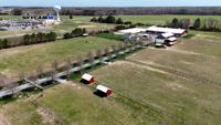
The Sussex County Council on Tuesday approved the controversial rezoning of the Belle Mead Farm to allow for the construction of a new commercial development near Lewes.

FOIA Emails Suggest US Wind Requested Coastal Towns Keep  Initial Offshore Wind Talks Private
Latest News

FOIA Emails Suggest US Wind Requested Coastal Towns Keep Initial Offshore Wind Talks Private

  • Kyle Orens, Sean Curtis
  • Updated Jun 5, 2024

New light is being shed on offshore wind company US Wind’s talks with the mayors comprising the Association of Coastal Towns (ACT) with the release of email correspondence between the two.

Offshore Wind Public Information Session in Lewes Scheduled for June
Latest News

Offshore Wind Public Information Session in Lewes Scheduled for June

  • Sean Curtis
  • Updated May 22, 2024

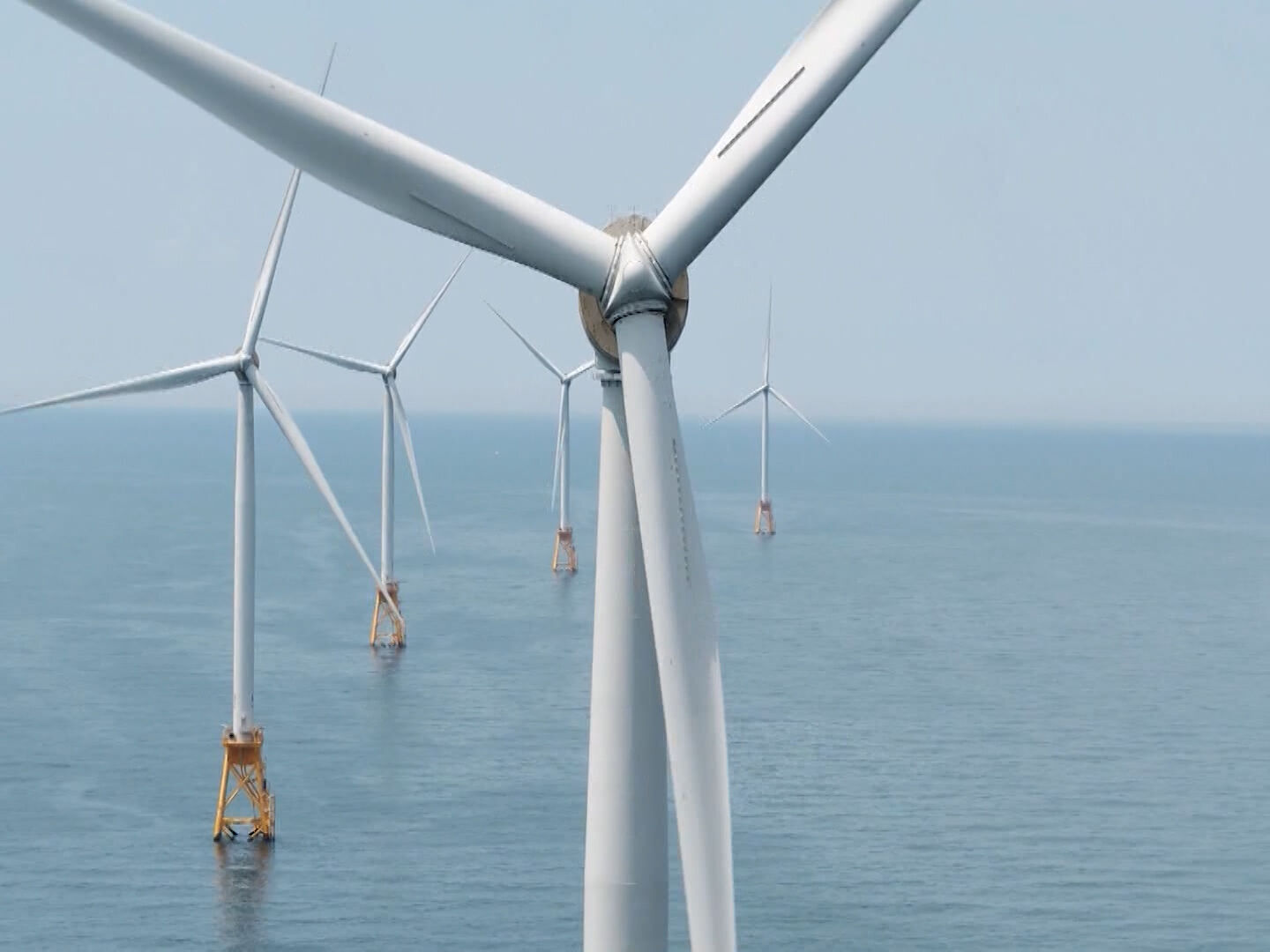
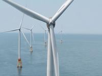
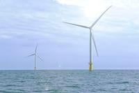
The Delaware Department of Natural Resources and Environmental Control (DNREC) says offshore wind developer U.S. Wind, Inc. has submitted permit applications to DNREC for its proposed project offshore of Maryland. 

Latest News

Cape Henlopen School District Referendum

  • Updated May 23, 2024

The Cape Henlopen School District is holding another referendum today on a proposed new tax rate to generate local revenue.

UNOFFICIAL RESULTS: Cape Henlopen School District Holds Second 2024 Referendum
Latest News

UNOFFICIAL RESULTS: Cape Henlopen School District Holds Second 2024 Referendum

  • Sean Curtis and Jack Ford
  • Updated May 21, 2024

The Cape Henlopen School District is holding another referendum today on a proposed new tax rate to generate local revenue.

DNREC to Hold Public Hearing on U.S. Wind Project Applications
Latest News

DNREC to Hold Public Hearing on U.S. Wind Project Applications

  • Sean Curtis
  • Updated May 2, 2024

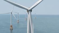
Offshore wind developer U.S. Wind, Inc. has submitted multiple permit applications to the Delaware Department of Natural Resources and Environmental Control (DNREC) for their proposed project off Delmarva.

site-logo
  • Facebook
  • Twitter
  • LinkedIn
  • YouTube
  • Instagram

Sections

  • Latest Newscasts
  • Local News
  • Weather
  • Features
  • DelmarvaLife
  • Outdoors Delmarva
  • Delmarva Home Show
  • CoastTV
  • Telemundo Delmarva
  • Delmarva Sports Network
  • Video Center

Services

  • Search
  • Pay My Bill
  • Advertise With Us
  • Contact Us
  • Careers
  • Internships

Browser Compatibility

Your browser is out of date and potentially vulnerable to security risks.
We recommend switching to one of the following browsers:

Microsoft Edge Google Chrome Firefox
FCC Public File Applications & Related Materials EEO Public File Report FCC Closed Captioning Concerns Children's Programming Transparency Requirements for Group Health Plans
© Copyright 2026 WBOC TV 1729 N. Salisbury BLVD, Salisbury, MD  | Terms of Use  | Privacy Policy
Powered by BLOX Content Management System from BLOX Digital.