


Forecast Updated on Monday, March 28, 2022, at 4:00am by WBOC Meteorologist Mike Lichniak
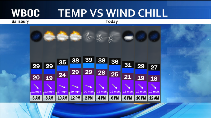
Today: Partly cloudy with the chance of some flurries or even a couple snow showers. Windy! Highs: 37-44. Winds: Nw 15-30+ mph.
Tonight: Mostly clear, breezy and chilly! Lows: 25-33. Winds: NW 10-20 mph.
Tuesday: Mostly sunny and breezy early. Highs: 42-48. Winds: NW 5-20+ mph.
Tuesday Night: Mostly clear to partly cloudy. Lows: 29-35. Winds: NE 5-15 mph.
Wednesday: Partly to mostly sunny. Highs: 55-62. Winds: E-SE 5-15 mph.
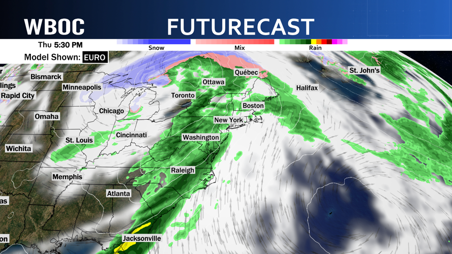
Thursday: Mostly sunny with scattered showers and thunderstorms in the afternoon and evening. Some of these storms could pack a punch! Breezy! Highs: 72-78. Winds: SW 10-20+ mph.

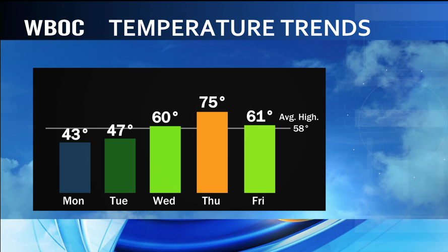
The start of the week is chilly as temperatures are going to continue to be well below average for this time of year. After the cold start this morning, temperatures will only climb back into the 30s and low 40s by the afternoon hours. Then you factor in the wind and will make things feel that much colder all day long! The wind will start to settle down overnight tonight. This will only allow temperatures to tumble into the 20s by the morning hours tomorrow. Good news is that temperatures will start to slowly rebound from here.

Tuesday will bring temperatures into the 40s as the wind begins to shift more out of the north and northeast by the afternoon hours. A warm front moves through the region overnight Tuesday into Wednesday with some extra clouds and the wind shift will start to push a big time warm up into the area for Wednesday and Thursday. Highs on Wednesday will climb up into the 50s and low 60s with highs on Wednesday should climb up into the 70s as the surge of warm air continues.
Eventually, all this warm air will lead to a problem and Thursday afternoon and evening hours could be a very active one on Delmarva.

A cold front will arrive from the west and interact with the warm air and lead to a chance of scattered showers and thunderstorms. The models are hinting at some very strong and some severe thunderstorms being possible on Thursday evening. Something to watch and a forecast we will fine tune over the week.
Behind the front, cooler air will spill in for Friday and the weekend with highs in the 50s and a good amount of sunshine.