Officials with the City of Salisbury have announced the Naylor Mill Water Main Extension Project will begin this month. An outside contractor is expected to begin work on June 29, with the project expected to be completed in June 2027.
Officials with the City of Salisbury have announced the Naylor Mill Water Main Extension Project will begin this month. An outside contractor is expected to begin work on June 29, with the project expected to be completed in June 2027.

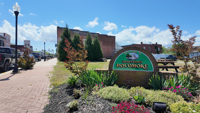
Pocomoke City Mayor Todd Nock has announced that phase 1 of the Mayor's Safe Path Initiative will officially begin on June 22 and continue through July 17. The mayor describes this as a major investment in city infrastructure and a commitment to improving the safety, appearance, and quality of life in Pocomoke.
Construction on Salisbury's ADA Ramp Improvement Project is wrapping up for the fiscal year, bringing new and upgraded curb ramps to neighborh…

Sussex County Vocational Technical School District says the opening of its new Sussex Technical High School has been pushed back by one year.
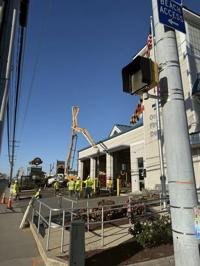
Recent work includes front access ramp repair, with newly-poured concrete expected to take a few weeks to set, according to OCFD.
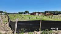
The Accomack County Board of Zoning Appeals affirmed an earlier stop-work order from the Zoning Administrator on the construction of a battery…

Asian man engineer using talkie walkie report working at rooftop building construction. Technician worker working checking hvac of office buil…

selective focus of building with windows near rooftop

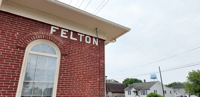
Local leaders have been discussing the future of growth in and around Felton, a conversation that has sparked opinions from business owners, farmers and longtime residents about what the community should look like in the years ahead.
Traffic cameras are already a familiar sight at some Delaware intersections and in active construction zones, but a proposal being considered …