

Forecast updated on Thursday, 23 May 2024, at 4:00 PM by WBOC Meteorologist Dan Satterfield (AMS Fellow-CBM).
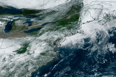
SYNOPSIS: Temperatures were warm across Delmarva today, and it was balmy in the afternoon as temperatures topped out around 80°. An upper level low will probably bring some widespread rain and thunder to the area early Friday with some pop up storms over the weekend. Tracking the timing of several upper level low pressure troughs is difficult, but most of the weekend will be dry.
DELMARVA FORECAST
Tonight: Mostly cloudy, and humid. A few passing thundershowers around. Some storm cells could be heavy. Low 65°. Beaches 60°. Wind: Light and variable.
Friday: Morning thundershowers around then some clearing PM. Some storm cells could produce heavy rainfall. High 83°. Beaches 75. Wind: SW/E 1-7 mph. Winds on the coast Variable at 6-10 mph.
Friday Night: Mostly cloudy, and humid. A few passing thundershowers around early. Low 62°. Beaches 60°. Wind: Light west.
Saturday: Thundershowers will be widely scattered later Saturday and Saturday night with partly sunny skies during the day. High 80-82°. Wind: Light. Beaches stay near 72°.
Forecast Discussion:
It will be mostly cloudy tonight with higher humidity and a light wind. There will be some scattered more thunderstorms and some may produce heavy rainfall. Look for low temps. near 66° by sunrise.
Friday looks cloudy early and an upper level low will bring morning showers and thunderstorms to the area. Some of these may produce heavy rainfall. Look for slowly clearing skies in the afternoon with high humidity. Winds will turn to the southwest behind a weak cool front by afternoon but there will be an east wind with a weak sea breeze near the coast.
The high temps. will reach near 83° inland, but the beaches will drop into the low 70's PM. Friday night looks partly cloudy with isolated showers and a low near 62°.
Saturday will be partly sunny and it will be warm and rather humid. Only isolated storms are expected during the day, but rain chances may climb late Saturday evening into early Sunday. Winds will turn to the south to east at less than 6 mph, but a sea breeze will develop on the beaches and cool the temps. back to the low 70's while it will reach 81°inland.
In the long-range: Sunday looks warm but there may be some thunderstorms around. Look for high temps. near 83° with a south breeze at 6-14 mph. Monday will be much the same with highest temps. around 82° but we will see some thundershowers around at any time Monday and Tuesday. Wednesday looks mild with thundershowers around as a cool front passes.
Thursday/Friday will be cooler and less humid with temps. in the mid 70's and lows in the 50's.
The average low for early May is 55° and the high is 76°.