Wicomico County’s main library is one step closer to a new home, with state funding helping move forward renovations at the former Ward Museum building near Schumaker Pond.
Wicomico County’s main library is one step closer to a new home, with state funding helping move forward renovations at the former Ward Museum building near Schumaker Pond.

One of the most successful college lacrosse coaches of all time is calling it a career. Salisbury University announced Tuesday that men's lacrosse head coach Jim Berkman is retiring after 38 years leading the program. Berkman described his nearly four-decade career as "a great run."

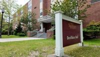
Wor-Wic Community College and Salisbury University announced a partnership today to make it easier for Wor-Wic students who received their associate degrees to transfer directly to Salisbury University to pursue bachelor's degrees.

Maryland Governor Wes Moore has signed the Wicomico Highway Pedestrian Safety Act into law, a local public safety measure aimed at restricting pedestrians from standing in dangerous areas along roadways in Wicomico County.

A public history initiative is launching to capture and share stories from Somerset, Wicomico and Worcester Counties for America's 250th anniversary.
Ocean Pines officials announced that Police Chief Tim Robinson will be retiring on June 12, 2026.

A controversial speaker’s appearance at Salisbury University drew both supporters and protesters to campus Wednesday night, months after a previous event was postponed over security concerns.


Students at SU will have the opportunity to engage with Orioles front office staff, learn the business of baseball, and receive hands-on experience in career areas like human resources, finance, and more. Orioles team leadership will also go to classrooms as students complete real-world capstone projects and present them to staff.
Salisbury University student Stephora Alberi discusses her scientific research bolstered by her recently awarded Gates Cambridge Scholarship.